


New York Topographic 3D Relief Map
The Collector’s Offer
Choose two eligible works and receive 20% off both. Choose three and the lowest-priced one is complimentary, a maximum saving of 33%.
Mix and match eligible standard maps and fine-art prints. No code is required; the offer is applied automatically at checkout.
Standard made-to-order configurations are included. Bespoke sizes, personalised designs and commissioned work are excluded.
Need delivery to different addresses? Contact us before ordering.The Collector’s Offer
Choose two eligible works and receive 20% off both. Choose three and the lowest-priced one is complimentary, a maximum saving of 33%.
Mix and match eligible standard maps and fine-art prints. No code is required; the offer is applied automatically at checkout.
Standard made-to-order configurations are included. Bespoke sizes, personalised designs and commissioned work are excluded.
Need delivery to different addresses? Contact us before ordering. Restored in London • Made in Australia

A museum-grade modern map from 2025, printed to order on premium materials. Read the story behind this map
Choose your size
Choose your finish


(More info)
Gift message & custom finish

If you want to add a gift message, or a finish (jigsaw, aluminium board, etc.) that is not available here, please request it in the "order note" when you check out.
Every order is custom made, so if you need the size adjusted slightly, or printed on an unusual material, just let us know. We've done thousands of custom orders over the years, so there's (almost) nothing we can't manage.
You can also contact us before you order, if you prefer!

- Made in Australia for fast, safe delivery
- Express delivery available
- Need advice? Call us or message on WhatsApp
Own a piece of history
8,000+ five-star reviews


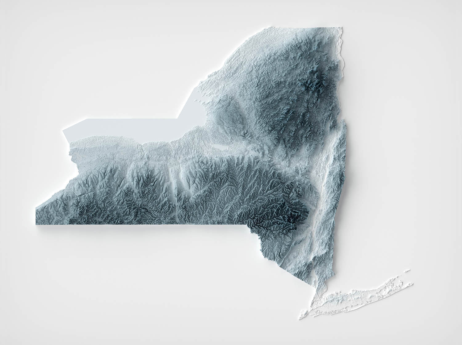
Embark on a journey through the diverse and iconic landscapes of New York with this uniquely crafted 3D topographical relief map. New...
Continue readingEmbark on a journey through the diverse and iconic landscapes of New York with this uniquely crafted 3D topographical relief map. New York's geography offers an eclectic mix of landscapes, from the bustling urban expanse of New York City to the serene natural beauty of the Adirondack Mountains.
Starting from the southeast, the map subtly highlights the metropolitan area of New York City, bordered by the Atlantic Ocean, where the hustle and bustle of urban life meets the calming waters. Moving northward, the topography transitions to the rolling hills of the Hudson Valley, a region renowned for its lush vineyards and orchards, gently carved by the Hudson River as it snakes its way toward the Atlantic.
Further north, the dramatic peaks of the Adirondack Mountains are captured in stunning detail. These ancient mountains, boasting the highest peaks in New York, such as Mount Marcy, offer a stark contrast to the flatter regions below. Off to the west, the Finger Lakes region appears as a series of long, slender lakes etched into the land, known for their unique glacial origins.
The map also captures the expansive forests of the Catskills, contributing to New York's reputation as a haven for outdoor enthusiasts, with their dense woodlands and pristine waterways. The western edge, near the border with Pennsylvania, gently rolls into the Appalachian Plateau, while the shores of Lake Erie and Lake Ontario are marked by their flat, fertile plains.
This 3D relief map of New York not only showcases the state's geographical diversity but also invites viewers to appreciate the unique interplay between natural beauty and human development, making it a perfect addition for anyone who cherishes the Empire State.
Please note: While this map looks very 3D, it is a 2D map, printed in two dimensions on paper or canvas.
About our Unique 3D Topographic Relief Maps
These aren’t just maps — they’re landscapes, sculpted with light and shadow.
Our shaded relief prints use ultra high resolution topographic data and a secret 3D rendering process to create the illusion of raised terrain — like the mountains are about to lift right off the page. No labels, no borders, no distractions. Just the raw shape of the land, brought to life in a clean, modern style.
They’re designed to feel timeless. Bold enough to be a centrepiece, subtle enough to blend in. A perfect gift for map lovers, mountain wanderers, or anyone who finds beauty in the shape of the Earth.
And of course, like any of our other maps, you can personalise this topographical map as well. Why not mark your favourite peaks, or the routes of your favourite hikes and cycle rides?
More Product Info
If you're not sure what size to order, or you're looking for a custom order of some kind – a different size, a different colour, a special frame – then please contact me. I usually respond within a few minutes.
You can see an example of my map personalisation service in the fifth image. Zoom in and take a look. My personalised maps are always very well received. Take a look at more examples of personalisation.
You can also choose to age your map to make it look older. This is popular amongst my customers who want their artwork to look like an older, antique print. You can see an example of ageing in the sixth product image, or go ahead and check out lots of examples of other aged artwork.
I can print and frame this beautiful topographical 3D map at sizes up to 3 metres (10ft). If you are looking for a size or framing option that isn't available online, please get in touch.
This map is available as a giclée print on acid free archival matte paper, or you can buy it framed. My standard frames come in six colours (black, dark brown, dark grey, antique gold, oak and white), and custom framing is available for an additional charge. My frames are glazed with super-clear museum-grade acrylic (perspex/acrylite), which is significantly less reflective than glass, safer, and will always arrive in perfect condition.
This map is also available as a float framed canvas, sometimes known as a shadow gap framed canvas or canvas floater. The map is printed on artist's cotton canvas and then stretched over a handmade box frame. We then "float" the canvas inside a wooden frame, which is available in a range of colours (black, dark brown, oak, antique gold and white). This is a wonderful way to present a map without glazing in front. See some examples of float framed canvas maps and explore the differences between my different finishes.
Embark on a journey through the diverse and iconic landscapes of New York with this uniquely crafted 3D topographical relief map. New York's geography offers an eclectic mix of landscapes, from the bustling urban expanse of New York City to the serene natural beauty of the Adirondack Mountains.
Starting from the southeast, the map subtly highlights the metropolitan area of New York City, bordered by the Atlantic Ocean, where the hustle and bustle of urban life meets the calming waters. Moving northward, the topography transitions to the rolling hills of the Hudson Valley, a region renowned for its lush vineyards and orchards, gently carved by the Hudson River as it snakes its way toward the Atlantic.
Further north, the dramatic peaks of the Adirondack Mountains are captured in stunning detail. These ancient mountains, boasting the highest peaks in New York, such as Mount Marcy, offer a stark contrast to the flatter regions below. Off to the west, the Finger Lakes region appears as a series of long, slender lakes etched into the land, known for their unique glacial origins.
The map also captures the expansive forests of the Catskills, contributing to New York's reputation as a haven for outdoor enthusiasts, with their dense woodlands and pristine waterways. The western edge, near the border with Pennsylvania, gently rolls into the Appalachian Plateau, while the shores of Lake Erie and Lake Ontario are marked by their flat, fertile plains.
This 3D relief map of New York not only showcases the state's geographical diversity but also invites viewers to appreciate the unique interplay between natural beauty and human development, making it a perfect addition for anyone who cherishes the Empire State.
Please note: While this map looks very 3D, it is a 2D map, printed in two dimensions on paper or canvas.
About our Unique 3D Topographic Relief Maps
These aren’t just maps — they’re landscapes, sculpted with light and shadow.
Our shaded relief prints use ultra high resolution topographic data and a secret 3D rendering process to create the illusion of raised terrain — like the mountains are about to lift right off the page. No labels, no borders, no distractions. Just the raw shape of the land, brought to life in a clean, modern style.
They’re designed to feel timeless. Bold enough to be a centrepiece, subtle enough to blend in. A perfect gift for map lovers, mountain wanderers, or anyone who finds beauty in the shape of the Earth.
And of course, like any of our other maps, you can personalise this topographical map as well. Why not mark your favourite peaks, or the routes of your favourite hikes and cycle rides?
More Product Info
If you're not sure what size to order, or you're looking for a custom order of some kind – a different size, a different colour, a special frame – then please contact me. I usually respond within a few minutes.
You can see an example of my map personalisation service in the fifth image. Zoom in and take a look. My personalised maps are always very well received. Take a look at more examples of personalisation.
You can also choose to age your map to make it look older. This is popular amongst my customers who want their artwork to look like an older, antique print. You can see an example of ageing in the sixth product image, or go ahead and check out lots of examples of other aged artwork.
I can print and frame this beautiful topographical 3D map at sizes up to 3 metres (10ft). If you are looking for a size or framing option that isn't available online, please get in touch.
This map is available as a giclée print on acid free archival matte paper, or you can buy it framed. My standard frames come in six colours (black, dark brown, dark grey, antique gold, oak and white), and custom framing is available for an additional charge. My frames are glazed with super-clear museum-grade acrylic (perspex/acrylite), which is significantly less reflective than glass, safer, and will always arrive in perfect condition.
This map is also available as a float framed canvas, sometimes known as a shadow gap framed canvas or canvas floater. The map is printed on artist's cotton canvas and then stretched over a handmade box frame. We then "float" the canvas inside a wooden frame, which is available in a range of colours (black, dark brown, oak, antique gold and white). This is a wonderful way to present a map without glazing in front. See some examples of float framed canvas maps and explore the differences between my different finishes.
Many of our maps and art prints are chosen as thoughtful gifts for homes, offices, studies and meaningful places.
Choose a framed option for the easiest ready-to-hang gift, or choose an unframed print if the recipient may prefer to select their own frame.
We make orders locally in 23 countries around the world, so gifts can often be produced close to the recipient. This helps them arrive faster, travel more safely, and avoid customs or import duty surprises.
- We can deliver directly to the recipient
- Framed pieces arrive ready to hang
- Unframed prints are carefully packed in a strong protective tube
- Almost every order is made locally, for faster, safer gifting
- 90-day returns give the recipient time to decide
If you are not sure what to choose, please contact us. We can help you pick the right map, size, finish or delivery option.
Most orders are made locally and delivered in around 2–3 working days, depending on the product, size and destination.
We print and frame maps and artwork in 23 countries around the world, so your order is usually made close to you or your recipient. That means faster delivery, less time in transit, and no customs or import duty surprises.
Personalised and customised pieces usually take an extra 1–2 working days, because we prepare your design and send it to you for approval before printing.
Very large framed orders can take a little longer, as they need extra care in production and delivery.
Every order is carefully packaged: unframed prints are sent in a strong protective tube, while framed pieces are securely packed with protective materials around the frame.
If you need your order by a particular date, please contact us before ordering. We’ll check the best production route and delivery option for your location.
Express delivery is available at checkout for most countries. Next-day delivery is available in the UK, US, Singapore and the UAE.
Your order is covered by our 90-day returns policy and 10-year guarantee.
Our standard frame is a gallery-style black ash hardwood frame, with a simple, modern look. It is approximately 20mm (0.8in) wide. You can also view some lovely customer photos of framed maps and art.
We use super-clear acrylic glazing, also known as Perspex or Acrylite, instead of traditional glass. It is lighter, safer, and has lower reflectivity, giving the artwork a clearer, cleaner appearance.
Six standard frame colours are available at no extra cost: black, dark brown, dark grey, oak, white, and antique gold. Custom framing and mounting/matting is also available for customers looking for something more specific.
Most maps, art prints, and illustrations are also available as a framed canvas. We use matte cotton canvas, stretch it over a sustainably sourced wooden box frame, and then float the piece within a wooden outer frame. The finished result is beautifully presented, with no glazing between you and the artwork.
All frames are supplied ready to hang, with either string or brackets fitted to the back. Very large frames will include heavy-duty hanging plates and/or a mounting baton. If you have any questions, please get in touch.
We can also supply old maps and artwork on canvas, foam board, cotton rag, and other materials.
If you would prefer to frame your map or artwork yourself, please read our size guide before ordering.
Every Unique Maps piece begins with an authentic cartographic source or an original design from our London studio.
For our historic maps, we source rare originals from libraries, archives, auction houses and private collections around the world. We carefully restore each map for print—repairing age-related damage, balancing colour and improving clarity while preserving its original detail, texture and character.
Once restored, the map is prepared for your chosen size and finish. Your piece is then printed and, where selected, framed close to its delivery destination.
Our map prints use acid-free 200gsm archival matte paper and fade-resistant pigment inks, creating a rich, non-glossy finish designed to last. Framed maps use crystal-clear optical acrylic and arrive ready to hang.
Canvas, cotton-rag and other specialist presentations are also available. Learn more about our materials and finishes.
Personalising your map
You can add a short title or dedication, mark one meaningful place, or request one considered visual detail. For personalised designs, we send a proof before printing and you can request changes before approval.
For more complex bespoke commissions, contact our design team.
Original or Aged
Choose Original for true-to-source colour, or Aged for a warmer, richer antique character created with our specialist ageing process. See examples of our Aged maps.
If you are not happy with your order for any reason, contact me and I'll get it fixed ASAP, free of charge. Please see my returns and refund policy for more information.
I am very confident you will like your restored map or art print. I have been doing this since 1984. I'm a 5-star Etsy seller. I have sold tens of thousands of maps and art prints and have over 5,000 real 5-star reviews. My work has been featured in interior design magazines, on the BBC, and on the walls of dozens of 5-star hotels.
I use a unique process to restore maps and artwork that is massively time consuming and labour intensive. Hunting down the original maps and illustrations can take months. I use state of the art and eye-wateringly expensive technology to scan and restore them. As a result, I guarantee my maps and art prints are a cut above the rest. I stand by my products and will always make sure you're 100% happy with what you receive.
Almost all of my maps and art prints look amazing at large sizes (200cm, 6.5ft+) and I can frame and deliver them to you as well, via special oversized courier. Contact me to discuss your specific needs.
Or try searching for something!


