

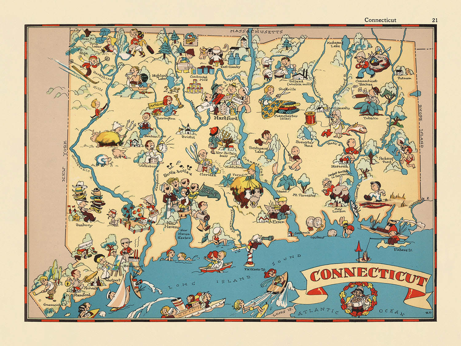
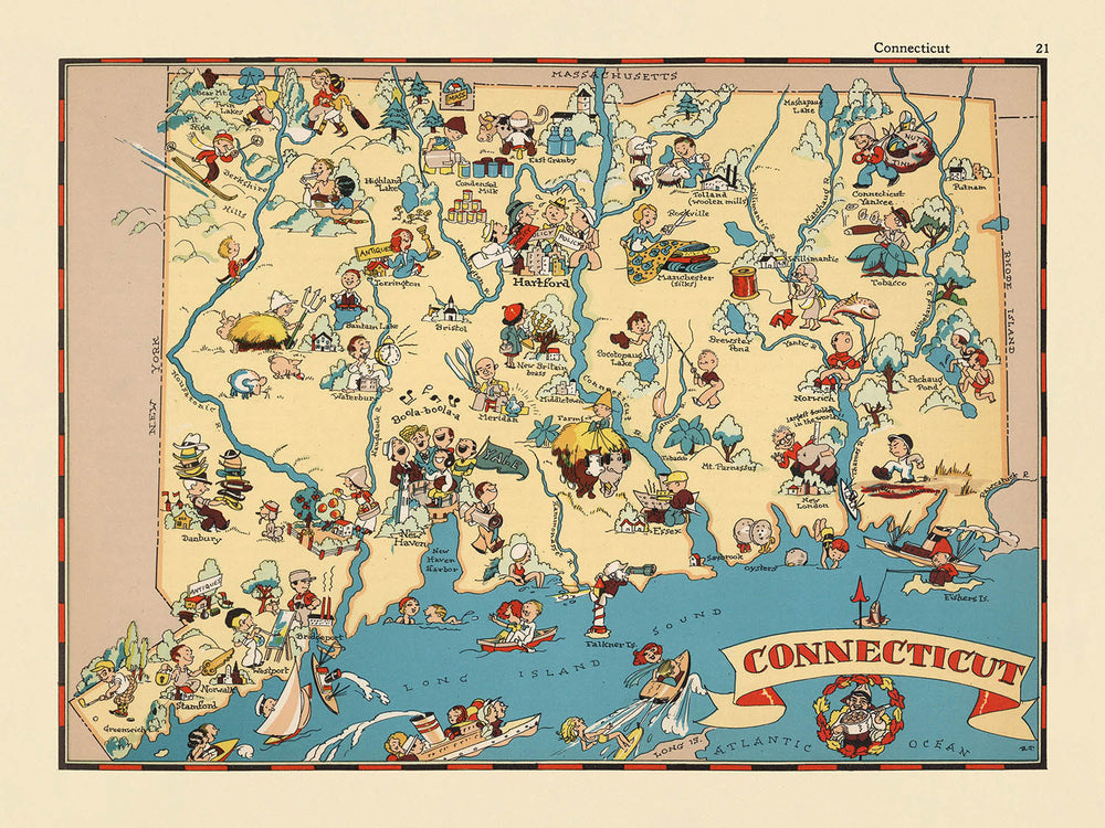


Mappa Pittorica del Connecticut di Ruth Taylor White, 1935: Bridgeport, New Haven, Yale, Long Island Sound, Fiume Connecticut

-
![]() Handmade in Australia
Handmade in Australia
-
FREE worldwide delivery in 2-3 days ⓘ
Free delivery in 2-3 days
Your map should be delivered in 2-3 working days with free delivery, worldwide.
We make maps by hand locally in 23 countries, including Australia
![]() . If you're buying a gift for someone in another country, we will make the map locally to them.
. If you're buying a gift for someone in another country, we will make the map locally to them.You will never pay import tax or customs duty.
Express delivery is available at checkout which can reduce the delivery time to 1-2 days.
Please note that personalised maps, and larger framed maps, can take longer to produce and deliver.
If you need your order to arrive by a certain date, contact me and we can discuss your options.
-
90 day money back guarantee
ⓘ
90 giorni per restituire e ottenere un rimborso
I prodotti possono essere restituiti entro 90 giorni per un rimborso completo, o scambio con un altro prodotto.
Per articoli personalizzati o su misura, potremmo offrirti un credito in negozio o una carta regalo non scadente, poiché non possiamo rivendere ordini personalizzati.
Se hai domande, contattaci. Per ulteriori informazioni, consulta la nostra politica di restituzione e scambio.

My maps are rare, museum-grade, restored old maps sourced from libraries, auction houses and private collections across the globe.
Framing & free personalisation available
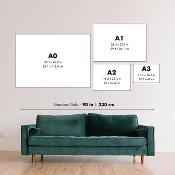
1. Select your size
2. Frame & personalise your map
Make your map unique with framing, hand-drawn customisation, vintage ageing, pop art text, unique 3D styling and moreGift message & custom finish

If you want to add a gift message, or a finish (jigsaw, aluminium board, etc.) that is not available here, please request it in the "order note" when you check out.
Every order is custom made, so if you need the size adjusted slightly, or printed on an unusual material, just let us know. We've done thousands of custom orders over the years, so there's (almost) nothing we can't manage.
You can also contact us before you order, if you prefer!

- Handmade locally. No import duty or tax
- FREE Delivery. Arrives in 2-3 days
- Love it or your money back
- Questions? WhatsApp me any time
Own a piece of history
5,000+ 5 star reviews


Entra nel vibrante mondo del Connecticut degli anni '30 con la mappa pittorica originale intitolata semplicemente "Connecticut," realizzata dalla rinomata Ruth Taylor White nel 1935. Questa incantevole mappa è più di un documento geografico; è un'opera d'arte affascinante che trasporta gli spettatori in un'epoca in cui lo Stato della Noce Moscata era in pieno fermento industriale, accademico e di fascino bucolico. Il giocoso cartiglio del titolo della mappa, immerso in un'esplosione di colori e fantasia, segnala immediatamente il delizioso viaggio che ci attende—uno che intreccia il tessuto culturale, storico e naturale del Connecticut come veniva visto quasi un secolo fa.
Ruth Taylor White, un'illustratrice celebrata della sua epoca, era famosa per la sua capacità di infondere umorismo e intuizioni storiche nelle mappe. Il suo stile unico è evidente in questo pezzo, dove colori vivaci e illustrazioni in stile cartone animato danno vita alle contee e ai paesaggi del Connecticut. L'approccio di White alla cartografia era quello di intrattenere tanto quanto informare, rendendo le sue mappe molto ricercate da collezionisti e appassionati di storia. Ogni elemento è meticolosamente reso, offrendo non solo accuratezza nei confini e nei fiumi, ma anche un senso del carattere locale e dell'industria che ha definito il Connecticut all'inizio del ventesimo secolo.
La mappa è una celebrazione visiva della geografia diversificata del Connecticut, dalle colline ondulate e dalle valli fertili alla costa vivace lungo il Long Island Sound. Il potente fiume Connecticut si snoda graziosamente attraverso lo stato, la cui importanza è sottolineata da vivaci illustrazioni di barche e attività lungo il fiume. I confini delle contee sono chiaramente delineati, mentre il sigillo dello stato si erge orgogliosamente come simbolo del passato ricco di storie del Connecticut. In tutta la mappa, si trovano riferimenti all'eredità agricola—campi di tabacco, frutteti e animali da fattoria—che riflettono il fondamento economico dello stato durante quell'epoca.
Ciò che rende davvero unica questa mappa sono le vignette fantasiose che catturano il ricco patrimonio culturale ed educativo del Connecticut. La Yale University, una delle istituzioni più antiche e prestigiose d'America, è rappresentata con un tocco di eleganza, mentre scene coloniali e immagini dei primi coloni evocano le profonde radici storiche della regione. Attività ricreative come la navigazione e la pesca sono illustrate in modo giocoso lungo i fiumi e la costa, evidenziando il legame duraturo dello stato con la terra e l'acqua. Questi dettagli affascinanti offrono uno sguardo nostalgico nella vita quotidiana e nel tempo libero dei residenti del Connecticut durante gli anni '30.
Un tour degli insediamenti della mappa rivela la duratura prominenza di città come Bridgeport, New Haven, Stamford e Hartford—ognuna rappresentata con cura e personalità. Anche città più piccole come Winsted, Derby e Ansonia sono rappresentate, sottolineando l'approccio completo della mappa alla geografia umana del Connecticut. L'inclusione attenta di queste comunità, ordinate per la loro importanza odierna, invita gli spettatori a riflettere sulla crescita dinamica e sulla trasformazione dello stato nel tempo. In ogni pennellata e etichetta, la mappa "Connecticut" di Ruth Taylor White si erge come un testamento all'arte, all'umorismo e alla curiosità storica che hanno definito un'epoca della cartografia americana.
Città e paesi su questa mappa
- Bridgeport
- New Haven
- Stamford
- Hartford
- Waterbury
- Norwalk
- Danbury
- New Britain
- West Hartford
- Greenwich
- Bristol
- Meriden
- Milford
- Middletown
- Shelton
- Torrington
- New London
- Ansonia
- Derby
- Winsted
Caratteristiche e Luoghi Notabili
- I principali fiumi, incluso il fiume Connecticut, sono illustrati e etichettati.
- La costa lungo Long Island Sound è rappresentata con abbellimenti artistici.
- Illustrazioni delle industrie locali, come l'agricoltura (ad es., la coltivazione del tabacco), sono visibili.
- Rappresentazioni pittoriche dell'Università di Yale e di altre istituzioni educative.
- Disegni di attività ricreative, come la navigazione e la pesca, lungo la costa e i fiumi.
- Illustrazioni fantasiose della fauna selvatica locale e degli animali da fattoria.
- I confini della contea sono delineati e etichettati.
- Il sigillo dello stato del Connecticut è illustrato.
- Vari motivi storici e culturali, come i primi coloni americani e scene coloniali, sono rappresentati.
- La mappa include un cartiglio decorativo con il nome e la data della mappa.
Contesto storico e di design
- Mapmaker originale: Ruth Taylor White.
- Data di creazione: 1935.
- Tipo di mappa: Mappa tematica e pittorica di contea o stato.
- Parte di un atlante pittorico fantasioso degli Stati Uniti, noto per le sue illustrazioni divertenti e fantasiose.
- Presenta illustrazioni vivaci, colorate e simili a cartoni animati che catturano scene stereotipate e la cultura locale del Connecticut negli anni '30.
- Rappresenta la cultura unica del Connecticut, le industrie e i luoghi notevoli attraverso opere d'arte giocose e imaginative.
- Offre uno sguardo nostalgico e leggero nel passato del Connecticut, riflettendo sia la cultura che le percezioni popolari dell'epoca.
- La mappa immerge gli spettatori in una rappresentazione giocosa dello stato, combinando flair artistico con informazioni geografiche e culturali.
Si prega di controllare le immagini per assicurarsi che una specifica città o luogo sia mostrato su questa mappa. Puoi anche contattarci e chiedere di controllare la mappa per te.
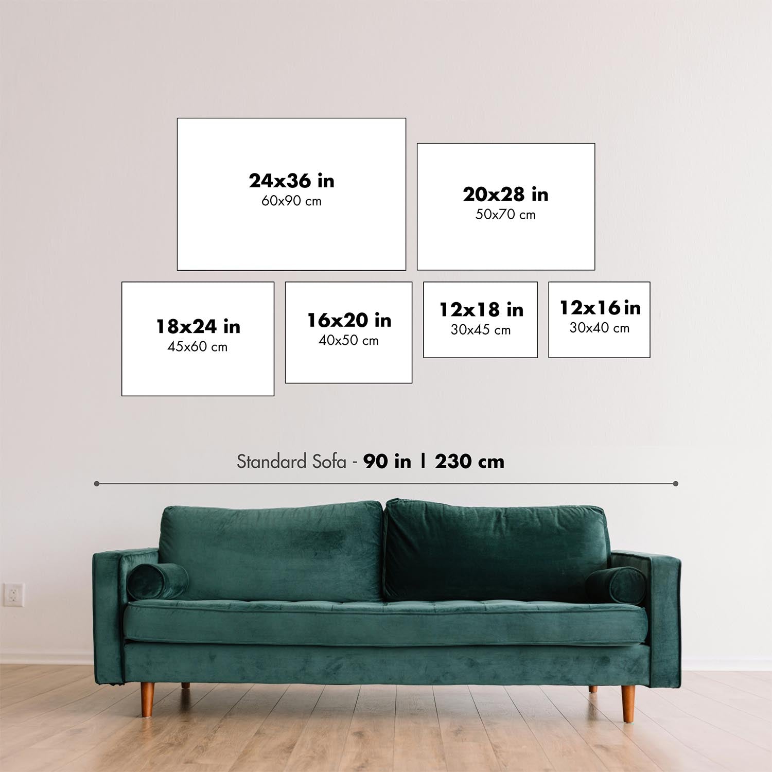
Questa mappa appare fantastica in qualsiasi dimensione, ma consiglio sempre di optare per una dimensione più grande se hai spazio. In questo modo puoi facilmente distinguere tutti i dettagli.
Questa mappa appare incredibile in dimensioni fino a 50 pollici (125 cm). Se stai cercando una mappa più grande, per favore contattaci.
Il modello nelle immagini dell'inserzione sta tenendo la versione 18x24 pollici (45x60 cm) di questa mappa.
La quinta immagine dell'inserzione mostra un esempio del mio servizio di personalizzazione della mappa.
Se stai cercando qualcosa di leggermente diverso, dai un'occhiata alla mia collezione delle migliori mappe antiche per vedere se qualcosa altro attira la tua attenzione.
Per favore contattami per verificare se una certa posizione, luogo o caratteristica è mostrata su questa mappa.
Questo sarebbe un meraviglioso regalo per un compleanno, Natale, Festa del Papà, partenza dal lavoro, anniversario o inaugurazione di una casa per qualcuno delle aree coperte da questa mappa.
Questa mappa è disponibile come stampa giclée su carta opaca archiviata senza acidi, oppure puoi acquistarla incorniciata. La cornice è una semplice cornice nera che si adatta alla maggior parte degli stili. Per favore contattaci se desideri un colore o un materiale di cornice diverso. Le mie cornici sono dotate di acrilico super chiaro di grado museale (perspex/acrylite), che è significativamente meno riflettente del vetro, più sicuro e arriverà sempre in condizioni perfette.
This map is also available as a float framed canvas, sometimes known as a shadow gap framed canvas or canvas floater. The map is printed on artist's cotton canvas and then stretched over a handmade box frame. We then "float" the canvas inside a wooden frame, which is available in a range of colours (black, dark brown, oak, antique gold and white). This is a wonderful way to present a map without glazing in front. See some examples of float framed canvas maps and explore the differences between my different finishes.
For something truly unique, this map is also available in "Unique 3D", our trademarked process that dramatically transforms the map so that it has a wonderful sense of depth. We combine the original map with detailed topography and elevation data, so that mountains and the terrain really "pop". For more info and examples of 3D maps, check my Unique 3D page.
For most orders, delivery time is about 3 working days. Personalised and customised products take longer, as I have to do the personalisation and send it to you for approval, which usually takes 1 or 2 days.
Please note that very large framed orders usually take longer to make and deliver.
If you need your order to arrive by a certain date, please contact me before you order so that we can find the best way of making sure you get your order in time.
I print and frame maps and artwork in 23 countries around the world. This means your order will be made locally, which cuts down on delivery time and ensures that it won't be damaged during delivery. You'll never pay customs or import duty, and we'll put less CO2 into the air.
All of my maps and art prints are well packaged and sent in a rugged tube if unframed, or surrounded by foam if framed.
I try to send out all orders within 1 or 2 days of receiving your order, though some products (like face masks, mugs and tote bags) can take longer to make.
If you select Express Delivery at checkout your order we will prioritise your order and send it out by 1-day courier (Fedex, DHL, UPS, Parcelforce).
Next Day delivery is also available in some countries (US, UK, Singapore, UAE) but please try to order early in the day so that we can get it sent out on time.
My standard frame is a gallery style black ash hardwood frame. It is simple and quite modern looking. My standard frame is around 20mm (0.8in) wide.
I use super-clear acrylic (perspex/acrylite) for the frame glass. It's lighter and safer than glass - and it looks better, as the reflectivity is lower.
Six standard frame colours are available for free (black, dark brown, dark grey, oak, white and antique gold). Custom framing and mounting/matting is available if you're looking for something else.
Most maps, art and illustrations are also available as a framed canvas. We use matte (not shiny) cotton canvas, stretch it over a sustainably sourced box wood frame, and then 'float' the piece within a wood frame. The end result is quite beautiful, and there's no glazing to get in the way.
All frames are provided "ready to hang", with either a string or brackets on the back. Very large frames will have heavy duty hanging plates and/or a mounting baton. If you have any questions, please get in touch.
See some examples of my framed maps and framed canvas maps.
Alternatively, I can also supply old maps and artwork on canvas, foam board, cotton rag and other materials.
If you want to frame your map or artwork yourself, please read my size guide first.
Alcune delle mie vecchie mappe sono ora disponibili come tele incorniciate. Per favore contattami se desideri ordinare una dimensione che non è disponibile nel mio negozio.
Le vecchie mappe su tela sono un'alternativa interessante alle mappe incorniciate in modo convenzionale. A seconda del tuo gusto personale e dell'arredamento della stanza, le mappe su tela possono "risaltare" un po' di più rispetto a una mappa incorniciata.
My maps are extremely high quality reproductions of original maps.
I source original, rare maps from libraries, auction houses and private collections around the world, restore them at my London workshop, and then use specialist giclée inks and printers to create beautiful maps that look even better than the original.
My maps are printed on acid-free archival matte (not glossy) paper that feels very high quality and almost like card. In technical terms the paper weight/thickness is 10mil/200gsm. It's perfect for framing.
I print with Epson ultrachrome giclée UV fade resistant pigment inks - some of the best inks you can find.
I can also make maps on canvas, cotton rag and other exotic materials.
Learn more about The Unique Maps Co.
Map personalisation
If you're looking for the perfect anniversary or housewarming gift, I can personalise your map to make it truly unique. For example, I can add a short message, or highlight an important location, or add your family's coat of arms.
The options are almost infinite. Please see my map personalisation page for some wonderful examples of what's possible.
To order a personalised map, select "personalise your map" before adding it to your basket.
Get in touch if you're looking for more complex customisations and personalisations.
Map ageing
I have been asked hundreds of times over the years by customers if they could buy a map that looks even older.
Well, now you can, by selecting Aged before you add a map to your basket.
All the product photos you see on this page show the map in its Original form. This is what the map looks like today.
If you select Aged, I will age your map by hand, using a special and unique process developed through years of studying old maps, talking to researchers to understand the chemistry of aging paper, and of course... lots of practice!
If you're unsure, stick to the Original colour of the map. If you want something a bit darker and older looking, go for Aged.
Se non sei soddisfatto del tuo ordine per qualsiasi motivo, contattami per un rimborso senza problemi. Si prega di consultare la nostra politica di reso e rimborso per ulteriori informazioni.
Sono molto sicuro che ti piacerà la tua mappa restaurata o la stampa d'arte. Lo faccio dal 1984. Sono un venditore Etsy a 5 stelle. Ho venduto decine di migliaia di mappe e stampe d'arte e ho oltre 5.000 recensioni reali a 5 stelle.
Utilizzo un processo unico per restaurare mappe e opere d'arte che richiede molto tempo e lavoro. Trovare le mappe e le illustrazioni originali può richiedere mesi. Utilizzo tecnologia all'avanguardia e incredibilmente costosa per scannerizzare e restaurarle. Di conseguenza, garantisco che le mie mappe e stampe d'arte siano superiori alle altre - ecco perché posso offrire un rimborso senza problemi.
Quasi tutte le mie mappe e stampe d'arte sembrano fantastiche a grandi dimensioni (200 cm, 6,5 piedi+) e posso anche incorniciarle e consegnarle a te, tramite un corriere speciale per oggetti di grandi dimensioni. Contattami per discutere delle tue esigenze specifiche.
Or try searching for something!


