


Old Map of Damascus by Braun & Hogenberg, 1599: Fortified Walls, Mosques, Via Recta, Mountains, Waterways

-
![]() Handmade in Australia
Handmade in Australia
-
FREE worldwide delivery in 2-3 days ⓘ
Free delivery in 2-3 days
Your map should be delivered in 2-3 working days with free delivery, worldwide.
We make maps by hand locally in 23 countries, including Australia
![]() . If you're buying a gift for someone in another country, we will make the map locally to them.
. If you're buying a gift for someone in another country, we will make the map locally to them.You will never pay import tax or customs duty.
Express delivery is available at checkout which can reduce the delivery time to 1-2 days.
Please note that personalised maps, and larger framed maps, can take longer to produce and deliver.
If you need your order to arrive by a certain date, contact me and we can discuss your options.
-
90 day money back guarantee
ⓘ
90 days to return and refund
Products can be returned within 90 days for a full refund, or exchange for another product.
For personalised or custom made items, we may offer you store credit or a non-expiring gift card, as we cannot resell personalised orders.
If you have any questions, get in touch. For more information, see our full returns & exchanges policy.

My maps are rare, museum-grade, restored old maps sourced from libraries, auction houses and private collections across the globe.
Framing & free personalisation available
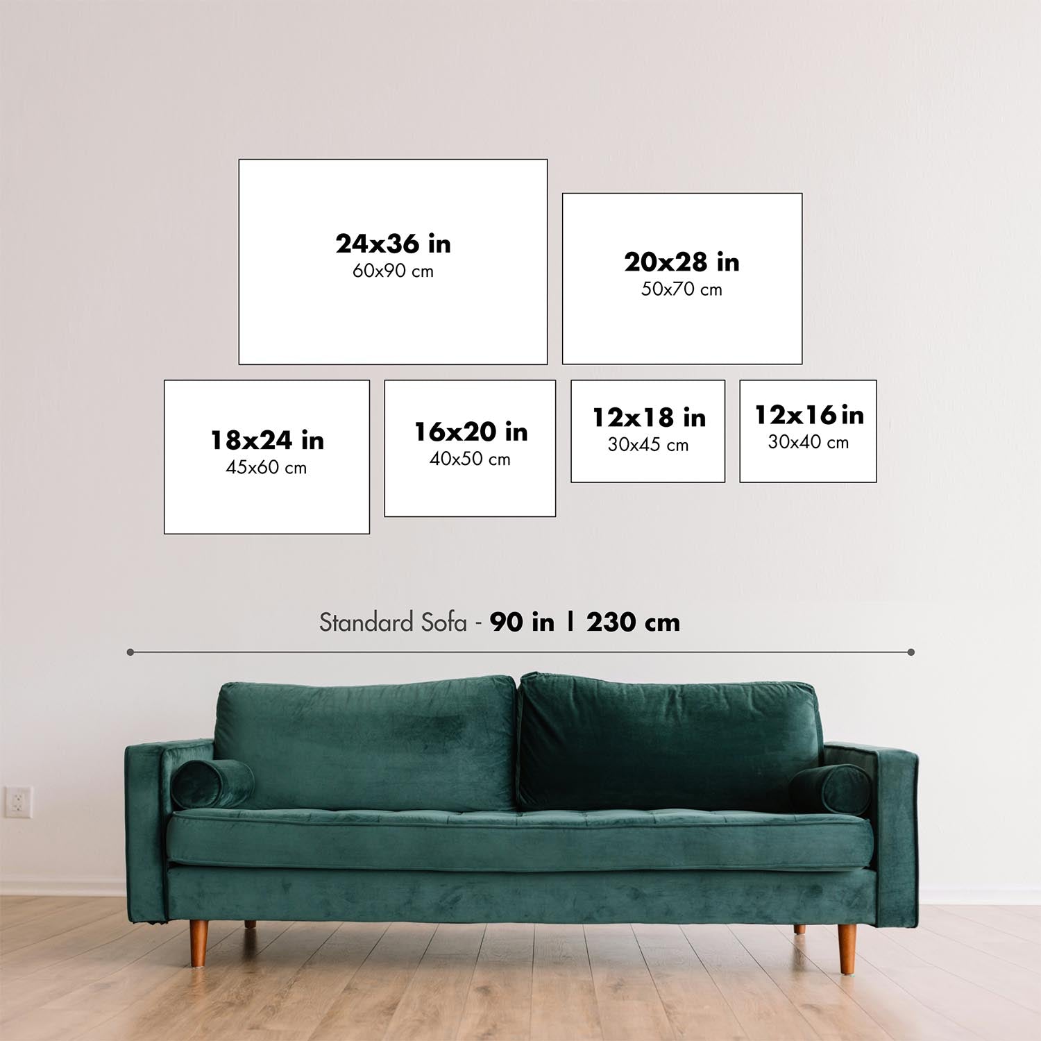
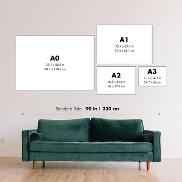
1. Select your size
2. Customise your map
Personalise your map with framing, hand-drawn customisation, vintage ageing, pop art text, unique 3D styling and moreGift message & custom finish

If you want to add a gift message, or a finish (jigsaw, aluminium board, etc.) that is not available here, please request it in the "order note" when you check out.
Every order is custom made, so if you need the size adjusted slightly, or printed on an unusual material, just let us know. We've done thousands of custom orders over the years, so there's (almost) nothing we can't manage.
You can also contact us before you order, if you prefer!

- Handmade locally. No import duty or tax
- FREE Delivery. Arrives in 2-3 days
- Love it or your money back
- Questions? WhatsApp me any time
Own a piece of history
5,000+ 5 star reviews


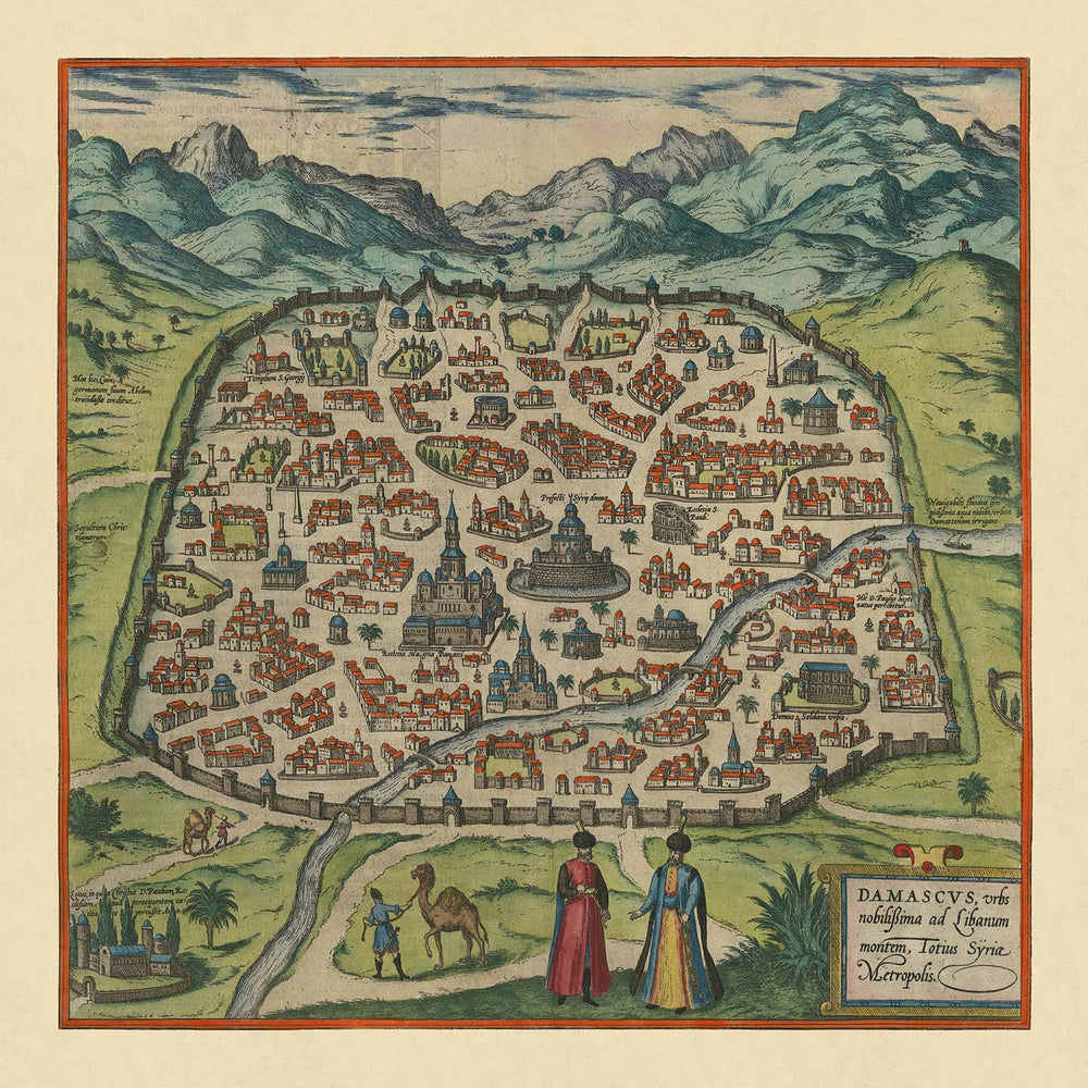
Presenting the "Damascus, urbs nobilissima ad Libanum montem Totius Syriae Metropolis," a captivating birds-eye view map created by the renowned cartographers Georg Braun and Frans Hogenberg in 1599. This exquisite map is part of the celebrated Civitates Orbis Terrarum, an atlas that provided a comprehensive view of urban life in the late 16th century. Damascus, one of the oldest continuously inhabited cities in the world, is depicted in remarkable detail, showcasing its fortified walls, various buildings, and bustling public squares. The map is a testament to the city's historical significance and cultural prestige during the Ottoman rule.
The map intricately illustrates the layout of Damascus, highlighting its fortified walls and distinct neighborhoods. Each cluster of buildings represents different parts of the city, providing a glimpse into the urban planning and architectural styles of the time. Prominent landmarks, such as the mosques and public buildings, are meticulously detailed, offering a visual journey through the city's rich history. The presence of costumed locals and camels in the foreground adds a touch of daily life, making the map not just a geographical representation but a vivid portrayal of the city's vibrant culture.
Damascus' historical significance is further emphasized by its role as the capital of the Umayyad Caliphate from 661 to 750. The map captures the essence of a city that has witnessed numerous political and cultural transformations. After the victory of the Abbasid dynasty, the city's political importance waned, only to regain prominence during the Ayyubid and Mamluk periods. The Ottoman era brought both decay and cultural prestige, with the construction of significant monuments such as the Tekkiye al-Sulaimaniyah in 1560, designed by the famous Ottoman architect Mimar Sinan.
The map also showcases the natural beauty surrounding Damascus, with a mountainous backdrop and green areas that highlight the city's strategic location near the Libanus mountain range. Waterways running through and around the city are depicted, emphasizing the importance of these rivers in the city's development and daily life. The lush parks and gardens depicted on the map provide a glimpse into the recreational spaces enjoyed by the city's inhabitants, adding to the overall charm and allure of this historic city.
Georg Braun and Frans Hogenberg's work on the Civitates Orbis Terrarum is a monumental achievement in the history of cartography. Their collaboration brought together the talents of over 100 artists and topographers, resulting in an atlas that offers an incredibly comprehensive view of urban life in the late 16th century. This map of Damascus is a prime example of their dedication to detail and artistic excellence, making it a valuable addition to any collection of historical maps. It serves as a window into the past, allowing us to explore the rich history and cultural heritage of one of the world's most storied cities.
Streets and roads on this map
- Via Recta
Notable Features & Landmarks
- Illustrations:
- Costumed locals and camels in the foreground.
- Landmarks:
- The fortified walls of Damascus.
- Various prominent buildings, including what appears to be mosques and public buildings.
- Neighbourhoods:
- Distinct clusters of buildings representing different parts of the city.
- Large parks:
- Green areas surrounding the city walls.
- Other notable features:
- The mountainous backdrop.
- Waterways running through and around the city.
Historical and design context
- Name of the map: Damascus, urbs nobilissima ad Libanum montem Totius Syriae Metropolis
- Date of creation: 1599
- Mapmaker/Publisher: Georg Braun & Frans Hogenberg
- Interesting context about the mapmaker: Georg Braun and Frans Hogenberg began creating a comprehensive atlas of the cities of the world in 1572. Their work, Civitates Orbis Terrarum, included over 546 views and was edited by Georg Braun, with many engravings by Frans Hogenberg.
- Themes and topics shown on the map:
- City layout: Fortified walls, various buildings, public squares, and places of interest.
- Local life: Costumed locals and camels in the foreground.
- Historical significance: Damascus is one of the oldest continuously inhabited cities, significant for its history as the capital of the Umayyad Caliphate and its role during the Ottoman rule.
- Countries and regions shown on the map: The map focuses specifically on the city of Damascus in Syria.
- Design and style context: Birds-eye view pictorial map, typical of the late 16th-century cartographic style, providing a detailed and artistic representation of urban life.
- Historical significance:
- Damascus' history: Chosen as the capital of the Umayyad Caliphate from 661 to 750, saw political decline during the Abbasid era, and regained importance during the Ayyubid and Mamluk periods.
- Ottoman rule: The city decayed but maintained cultural prestige. Key Ottoman monuments were constructed, such as the Tekkiye al-Sulaimaniyah in 1560.
- Civitates Orbis Terrarum: This work is a significant source for understanding urban life in the late 16th century, providing early views of many cities.
Please double check the images to make sure that a specific town or place is shown on this map. You can also get in touch and ask us to check the map for you.
This map looks great at every size, but I always recommend going for a larger size if you have space. That way you can easily make out all of the details.
This map looks amazing at sizes all the way up to 50in (125cm). If you are looking for a larger map, please get in touch.
The model in the listing images is holding the 16x16in (40x40cm) version of this map.
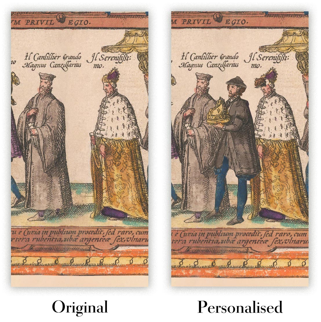
The fifth listing image shows an example of my map personalisation service.
If you’re looking for something slightly different, check out my collection of the best old maps to see if something else catches your eye.
Please contact me to check if a certain location, landmark or feature is shown on this map.
This would make a wonderful birthday, Christmas, Father's Day, work leaving, anniversary or housewarming gift for someone from the areas covered by this map.
This map is available as a giclée print on acid free archival matte paper, or you can buy it framed. The frame is a nice, simple black frame that suits most aesthetics. Please get in touch if you'd like a different frame colour or material. My frames are glazed with super-clear museum-grade acrylic (perspex/acrylite), which is significantly less reflective than glass, safer, and will always arrive in perfect condition.
This map is also available as a float framed canvas, sometimes known as a shadow gap framed canvas or canvas floater. The map is printed on artist's cotton canvas and then stretched over a handmade box frame. We then "float" the canvas inside a wooden frame, which is available in a range of colours (black, dark brown, oak, antique gold and white). This is a wonderful way to present a map without glazing in front. See some examples of float framed canvas maps and explore the differences between my different finishes.
For something truly unique, this map is also available in "Unique 3D", our trademarked process that dramatically transforms the map so that it has a wonderful sense of depth. We combine the original map with detailed topography and elevation data, so that mountains and the terrain really "pop". For more info and examples of 3D maps, check my Unique 3D page.
For most orders, delivery time is about 3 working days. Personalised and customised products take longer, as I have to do the personalisation and send it to you for approval, which usually takes 1 or 2 days.
Please note that very large framed orders usually take longer to make and deliver.
If you need your order to arrive by a certain date, please contact me before you order so that we can find the best way of making sure you get your order in time.
I print and frame maps and artwork in 23 countries around the world. This means your order will be made locally, which cuts down on delivery time and ensures that it won't be damaged during delivery. You'll never pay customs or import duty, and we'll put less CO2 into the air.
All of my maps and art prints are well packaged and sent in a rugged tube if unframed, or surrounded by foam if framed.
I try to send out all orders within 1 or 2 days of receiving your order, though some products (like face masks, mugs and tote bags) can take longer to make.
If you select Express Delivery at checkout your order we will prioritise your order and send it out by 1-day courier (Fedex, DHL, UPS, Parcelforce).
Next Day delivery is also available in some countries (US, UK, Singapore, UAE) but please try to order early in the day so that we can get it sent out on time.
My standard frame is a gallery style black ash hardwood frame. It is simple and quite modern looking. My standard frame is around 20mm (0.8in) wide.
I use super-clear acrylic (perspex/acrylite) for the frame glass. It's lighter and safer than glass - and it looks better, as the reflectivity is lower.
Six standard frame colours are available for free (black, dark brown, dark grey, oak, white and antique gold). Custom framing and mounting/matting is available if you're looking for something else.
Most maps, art and illustrations are also available as a framed canvas. We use matte (not shiny) cotton canvas, stretch it over a sustainably sourced box wood frame, and then 'float' the piece within a wood frame. The end result is quite beautiful, and there's no glazing to get in the way.
All frames are provided "ready to hang", with either a string or brackets on the back. Very large frames will have heavy duty hanging plates and/or a mounting baton. If you have any questions, please get in touch.
See some examples of my framed maps and framed canvas maps.
Alternatively, I can also supply old maps and artwork on canvas, foam board, cotton rag and other materials.
If you want to frame your map or artwork yourself, please read my size guide first.
My maps are extremely high quality reproductions of original maps.
I source original, rare maps from libraries, auction houses and private collections around the world, restore them at my London workshop, and then use specialist giclée inks and printers to create beautiful maps that look even better than the original.
My maps are printed on acid-free archival matte (not glossy) paper that feels very high quality and almost like card. In technical terms the paper weight/thickness is 10mil/200gsm. It's perfect for framing.
I print with Epson ultrachrome giclée UV fade resistant pigment inks - some of the best inks you can find.
I can also make maps on canvas, cotton rag and other exotic materials.
Learn more about The Unique Maps Co.
Map personalisation
If you're looking for the perfect anniversary or housewarming gift, I can personalise your map to make it truly unique. For example, I can add a short message, or highlight an important location, or add your family's coat of arms.
The options are almost infinite. Please see my map personalisation page for some wonderful examples of what's possible.
To order a personalised map, select "personalise your map" before adding it to your basket.
Get in touch if you're looking for more complex customisations and personalisations.
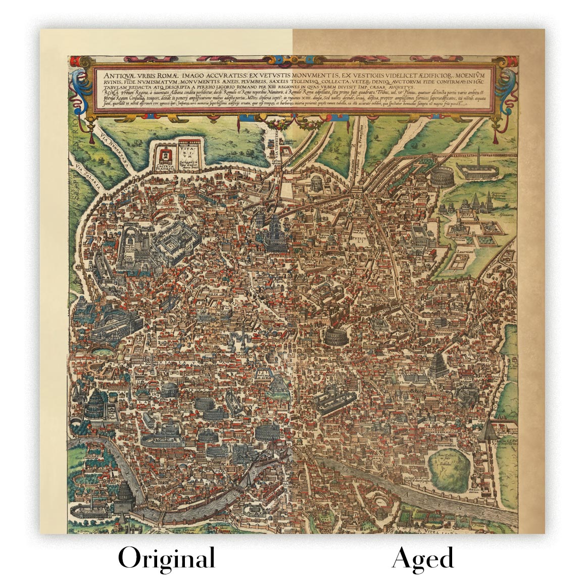
Map ageing
I have been asked hundreds of times over the years by customers if they could buy a map that looks even older.
Well, now you can, by selecting Aged before you add a map to your basket.
All the product photos you see on this page show the map in its Original form. This is what the map looks like today.
If you select Aged, I will age your map by hand, using a special and unique process developed through years of studying old maps, talking to researchers to understand the chemistry of aging paper, and of course... lots of practice!
If you're unsure, stick to the Original colour of the map. If you want something a bit darker and older looking, go for Aged.
If you are not happy with your order for any reason, contact me for a no-quibble refund. Please see our returns and refund policy for more information.
I am very confident you will like your restored map or art print. I have been doing this since 1984. I'm a 5-star Etsy seller. I have sold tens of thousands of maps and art prints and have over 5,000 real 5-star reviews.
I use a unique process to restore maps and artwork that is massively time consuming and labour intensive. Hunting down the original maps and illustrations can take months. I use state of the art and eye-wateringly expensive technology to scan and restore them. As a result, I guarantee my maps and art prints are a cut above the rest - that's why I can offer a no-quibble refund.
Almost all of my maps and art prints look amazing at large sizes (200cm, 6.5ft+) and I can frame and deliver them to you as well, via special oversized courier. Contact me to discuss your specific needs.
Or try searching for something!


