


Pictorial Map of Minnesota by Ruth Taylor White, 1935: Minneapolis, Saint Paul, Duluth, Land of 10,000 Lakes, Timber Industry

-
![]() Handmade in Australia
Handmade in Australia
-
FREE worldwide delivery in 2-3 days ⓘ
Free delivery in 2-3 days
Your map should be delivered in 2-3 working days with free delivery, worldwide.
We make maps by hand locally in 23 countries, including Australia
![]() . If you're buying a gift for someone in another country, we will make the map locally to them.
. If you're buying a gift for someone in another country, we will make the map locally to them.You will never pay import tax or customs duty.
Express delivery is available at checkout which can reduce the delivery time to 1-2 days.
Please note that personalised maps, and larger framed maps, can take longer to produce and deliver.
If you need your order to arrive by a certain date, contact me and we can discuss your options.
-
90 day money back guarantee
ⓘ
90 days to return and refund
Products can be returned within 90 days for a full refund, or exchange for another product.
For personalised or custom made items, we may offer you store credit or a non-expiring gift card, as we cannot resell personalised orders.
If you have any questions, get in touch. For more information, see our full returns & exchanges policy.

My maps are rare, museum-grade, restored old maps sourced from libraries, auction houses and private collections across the globe.
Framing & free personalisation available
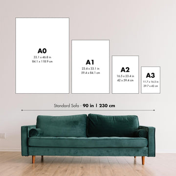
1. Select your size
2. Frame & personalise your map
Make your map unique with framing, hand-drawn customisation, vintage ageing, pop art text, unique 3D styling and moreGift message & custom finish

If you want to add a gift message, or a finish (jigsaw, aluminium board, etc.) that is not available here, please request it in the "order note" when you check out.
Every order is custom made, so if you need the size adjusted slightly, or printed on an unusual material, just let us know. We've done thousands of custom orders over the years, so there's (almost) nothing we can't manage.
You can also contact us before you order, if you prefer!

- Handmade locally. No import duty or tax
- FREE Delivery. Arrives in 2-3 days
- Love it or your money back
- Questions? WhatsApp me any time
Own a piece of history
5,000+ 5 star reviews


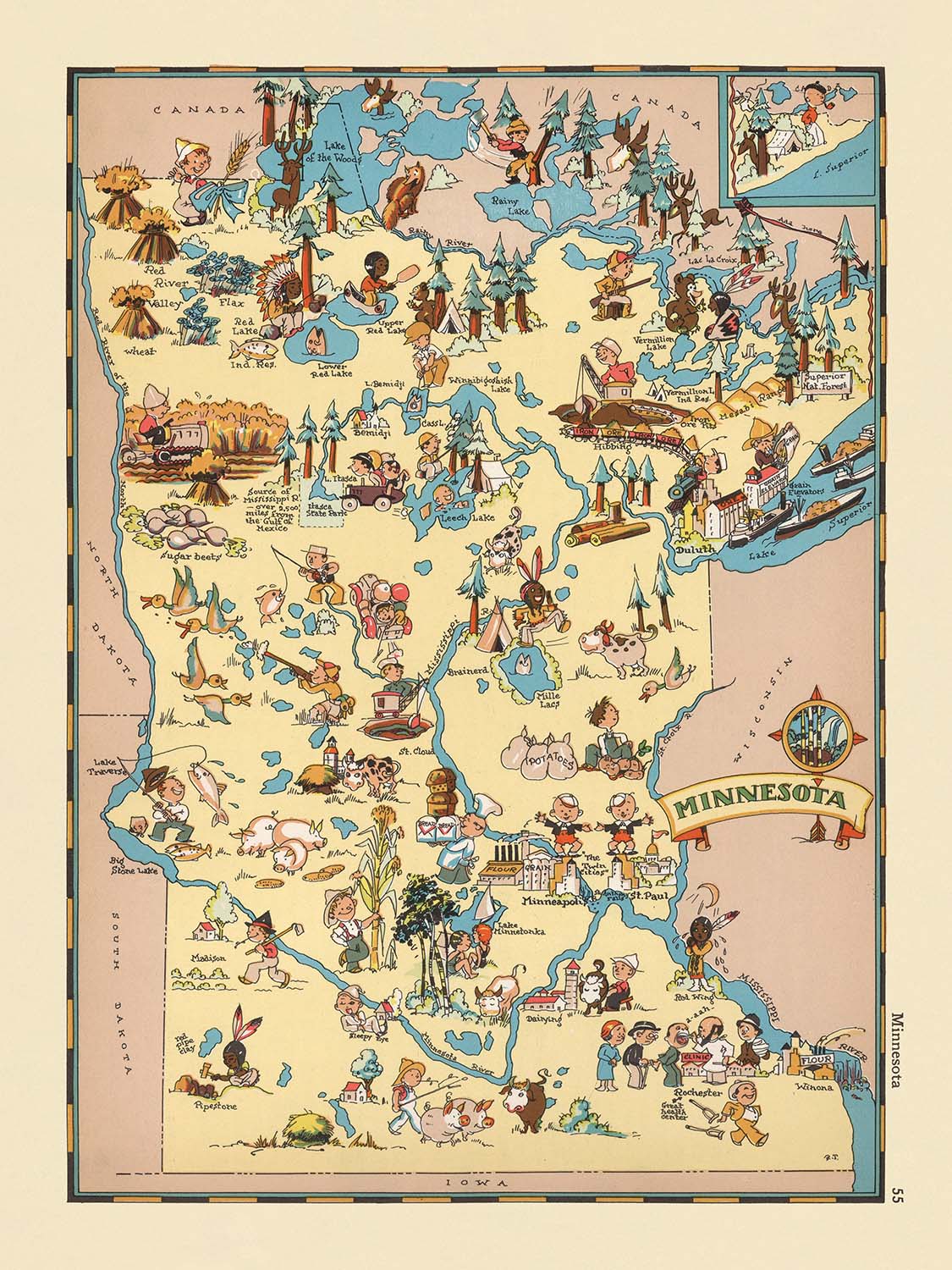
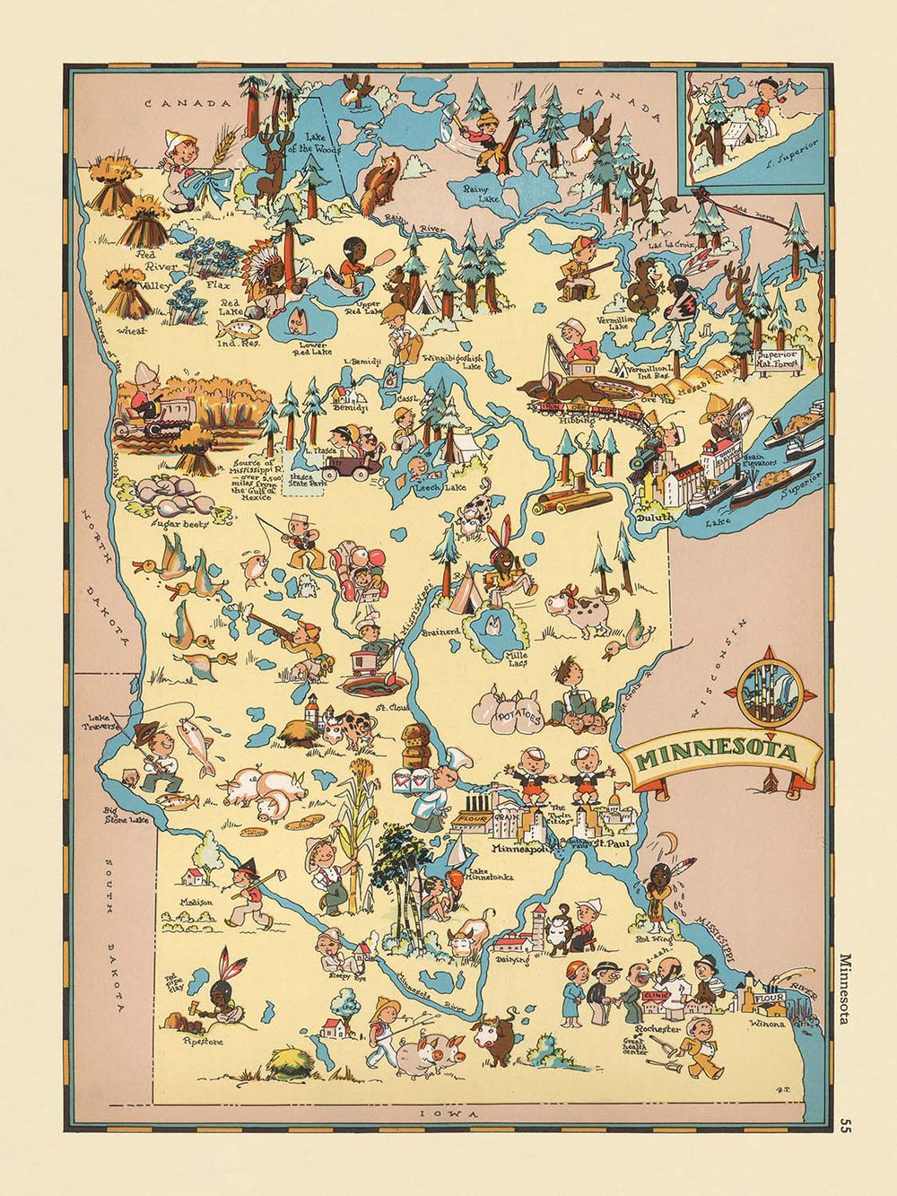
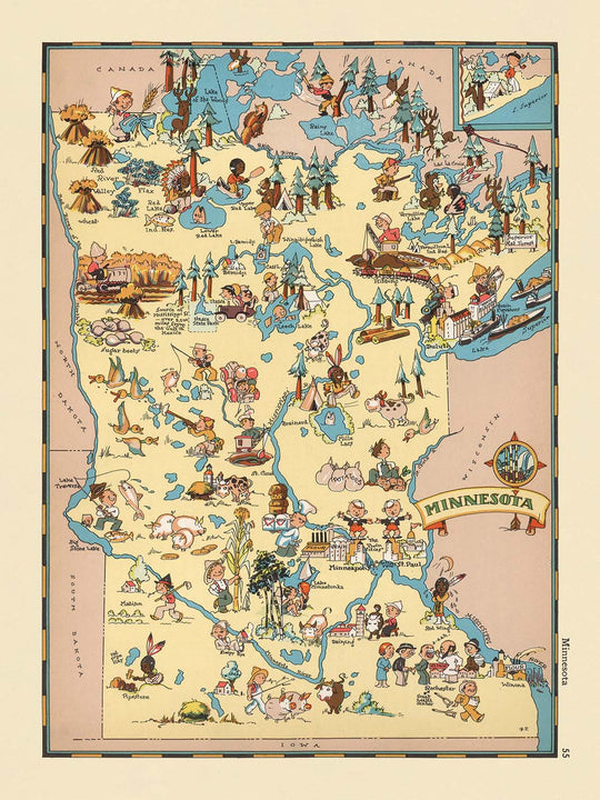
Step into the vibrant world of 1930s America with “Minnesota,” a captivating pictorial map crafted by the renowned Ruth Taylor White in 1935. This enchanting cartographic piece is far more than a simple geographic reference—it is a celebration of Minnesota’s spirit, culture, and landscape, as seen through the eyes of one of the era’s most imaginative mapmakers. The original title, “Minnesota,” hints at the artist’s intent to encapsulate the entire state’s essence within a single, visually rich tableau. From the moment you lay eyes on it, the map invites you to journey across county boundaries and into the heart of the North Star State.
Ruth Taylor White’s signature style is immediately evident in the map’s exuberant illustrations and whimsical design. Each county is meticulously outlined and labeled, yet the true charm lies in the delightful vignettes scattered across the landscape. Cartoonish figures—lumberjacks, fishermen, farmers, and winter sports enthusiasts—animate the map, offering a playful and affectionate portrayal of Minnesota’s people and traditions. White’s approach masterfully blends geographic accuracy with artistic license, creating a tapestry that is both informative and entertaining, and which reflects the optimism and humor of its time.
This map was created during a period when pictorial atlases were enjoying widespread popularity, offering Americans a way to explore their country through art as well as cartography. White’s depiction of Minnesota is particularly notable for its affectionate stereotypes and colorful references to the state’s cultural mosaic. Scandinavian settlers, Native Americans, and the ever-present wildlife are all brought to life in a manner that is both evocative and emblematic of the 1930s. The map’s playful caricatures and bustling scenes capture the imagination, making it an engaging artifact for collectors and historians alike.
The natural splendor of Minnesota is front and center, with lakes, rivers, and forests rendered in vibrant detail. The state’s reputation as the “Land of 10,000 Lakes” is celebrated through illustrations of fishing, canoeing, and abundant wildlife, while the northern forests teem with imagery of the timber industry. The map’s waterways are alive with steamboats and canoes, and the winter landscape is dotted with scenes of skiing and ice fishing, highlighting the state’s enduring connection to outdoor recreation. Each pictorial element serves as a window into the region’s geography and the livelihoods it has supported for generations.
Cities and towns are thoughtfully placed and labeled, with Minneapolis, Saint Paul, Duluth, and Rochester among the prominent settlements depicted. These urban centers, alongside smaller communities such as Bemidji, Hibbing, and Red Wing, are seamlessly woven into the pictorial narrative, underscoring their roles in the state’s development. The map’s playful border and hand-drawn title cartouche further enhance its charm, while its historical significance lies in its unique perspective—a visual time capsule that captures Minnesota’s identity as it was celebrated nearly a century ago. This map is not merely a record of place, but a joyous homage to the state’s people, landscapes, and enduring legacy.
Cities and towns on this map
- Minneapolis
- Saint Paul
- Duluth
- Rochester
- St. Cloud
- Mankato
- Winona
- Bemidji
- Brainerd
- Hibbing
- Moorhead
- Fergus Falls
- Red Wing
- Austin
- Albert Lea
- Crookston
- Willmar
- Owatonna
- Faribault
- Virginia
Notable Features & Landmarks
- County boundaries and names are clearly outlined and labeled throughout the state.
- Numerous illustrations of people engaged in activities such as fishing, farming, and logging, reflecting Minnesota's traditional industries.
- Visual references to lakes and rivers, emphasizing Minnesota's reputation as the "Land of 10,000 Lakes."
- Illustrations of wildlife, including fish and deer, highlighting the state's natural resources.
- Cartoon depictions of Native Americans, Scandinavian settlers, and lumberjacks, reflecting the state's diverse heritage (note: these are stereotypical and reflect the era's attitudes).
- Drawings of agricultural activities, such as dairy farming and crop harvesting.
- Visual references to winter sports and recreation, including skiing and ice fishing.
- Illustrations of steamboats and canoes on the state's waterways.
- Pictorial representations of forests and timber industries in northern Minnesota.
- Decorative border and title cartouche in a playful, hand-drawn style.
Historical and design context
- Name of the map: Minnesota.
- Date of creation: 1935.
- Mapmaker: Ruth Taylor White.
- The map is part of a whimsical and imaginative pictorial or cartoon atlas of the United States, popular in the 1930s.
- The map is highly colorful and cartoonish, featuring playful illustrations and vibrant depictions of people, animals, and activities.
- The map highlights stereotypical scenes and cultural elements associated with Minnesota in the 1930s, using caricatures and humor to represent the state's character.
- The map provides insight into how Minnesota was viewed and represented in popular culture during the early 20th century, and serves as a valuable artifact for understanding historical perceptions and stereotypes.
- Ruth Taylor White was known for creating lively pictorial maps that combined geographic information with entertaining and informative illustrations.
- The map is a celebration of Minnesota's identity, making it both an artistic piece and a historical document.
Please double check the images to make sure that a specific town or place is shown on this map. You can also get in touch and ask us to check the map for you.
This map looks great at every size, but I always recommend going for a larger size if you have space. That way you can easily make out all of the details.
This map looks amazing at sizes all the way up to 50in (125cm). If you are looking for a larger map, please get in touch.
The model in the listing images is holding the 18x24in (45x60cm) version of this map.
The fifth listing image shows an example of my map personalisation service.
If you’re looking for something slightly different, check out my collection of the best old maps to see if something else catches your eye.
Please contact me to check if a certain location, landmark or feature is shown on this map.
This would make a wonderful birthday, Christmas, Father's Day, work leaving, anniversary or housewarming gift for someone from the areas covered by this map.
This map is available as a giclée print on acid free archival matte paper, or you can buy it framed. The frame is a nice, simple black frame that suits most aesthetics. Please get in touch if you'd like a different frame colour or material. My frames are glazed with super-clear museum-grade acrylic (perspex/acrylite), which is significantly less reflective than glass, safer, and will always arrive in perfect condition.
This map is also available as a float framed canvas, sometimes known as a shadow gap framed canvas or canvas floater. The map is printed on artist's cotton canvas and then stretched over a handmade box frame. We then "float" the canvas inside a wooden frame, which is available in a range of colours (black, dark brown, oak, antique gold and white). This is a wonderful way to present a map without glazing in front. See some examples of float framed canvas maps and explore the differences between my different finishes.
For something truly unique, this map is also available in "Unique 3D", our trademarked process that dramatically transforms the map so that it has a wonderful sense of depth. We combine the original map with detailed topography and elevation data, so that mountains and the terrain really "pop". For more info and examples of 3D maps, check my Unique 3D page.
For most orders, delivery time is about 3 working days. Personalised and customised products take longer, as I have to do the personalisation and send it to you for approval, which usually takes 1 or 2 days.
Please note that very large framed orders usually take longer to make and deliver.
If you need your order to arrive by a certain date, please contact me before you order so that we can find the best way of making sure you get your order in time.
I print and frame maps and artwork in 23 countries around the world. This means your order will be made locally, which cuts down on delivery time and ensures that it won't be damaged during delivery. You'll never pay customs or import duty, and we'll put less CO2 into the air.
All of my maps and art prints are well packaged and sent in a rugged tube if unframed, or surrounded by foam if framed.
I try to send out all orders within 1 or 2 days of receiving your order, though some products (like face masks, mugs and tote bags) can take longer to make.
If you select Express Delivery at checkout your order we will prioritise your order and send it out by 1-day courier (Fedex, DHL, UPS, Parcelforce).
Next Day delivery is also available in some countries (US, UK, Singapore, UAE) but please try to order early in the day so that we can get it sent out on time.
My standard frame is a gallery style black ash hardwood frame. It is simple and quite modern looking. My standard frame is around 20mm (0.8in) wide.
I use super-clear acrylic (perspex/acrylite) for the frame glass. It's lighter and safer than glass - and it looks better, as the reflectivity is lower.
Six standard frame colours are available for free (black, dark brown, dark grey, oak, white and antique gold). Custom framing and mounting/matting is available if you're looking for something else.
Most maps, art and illustrations are also available as a framed canvas. We use matte (not shiny) cotton canvas, stretch it over a sustainably sourced box wood frame, and then 'float' the piece within a wood frame. The end result is quite beautiful, and there's no glazing to get in the way.
All frames are provided "ready to hang", with either a string or brackets on the back. Very large frames will have heavy duty hanging plates and/or a mounting baton. If you have any questions, please get in touch.
See some examples of my framed maps and framed canvas maps.
Alternatively, I can also supply old maps and artwork on canvas, foam board, cotton rag and other materials.
If you want to frame your map or artwork yourself, please read my size guide first.
My maps are extremely high quality reproductions of original maps.
I source original, rare maps from libraries, auction houses and private collections around the world, restore them at my London workshop, and then use specialist giclée inks and printers to create beautiful maps that look even better than the original.
My maps are printed on acid-free archival matte (not glossy) paper that feels very high quality and almost like card. In technical terms the paper weight/thickness is 10mil/200gsm. It's perfect for framing.
I print with Epson ultrachrome giclée UV fade resistant pigment inks - some of the best inks you can find.
I can also make maps on canvas, cotton rag and other exotic materials.
Learn more about The Unique Maps Co.
Map personalisation
If you're looking for the perfect anniversary or housewarming gift, I can personalise your map to make it truly unique. For example, I can add a short message, or highlight an important location, or add your family's coat of arms.
The options are almost infinite. Please see my map personalisation page for some wonderful examples of what's possible.
To order a personalised map, select "personalise your map" before adding it to your basket.
Get in touch if you're looking for more complex customisations and personalisations.
Map ageing
I have been asked hundreds of times over the years by customers if they could buy a map that looks even older.
Well, now you can, by selecting Aged before you add a map to your basket.
All the product photos you see on this page show the map in its Original form. This is what the map looks like today.
If you select Aged, I will age your map by hand, using a special and unique process developed through years of studying old maps, talking to researchers to understand the chemistry of aging paper, and of course... lots of practice!
If you're unsure, stick to the Original colour of the map. If you want something a bit darker and older looking, go for Aged.
If you are not happy with your order for any reason, contact me for a no-quibble refund. Please see our returns and refund policy for more information.
I am very confident you will like your restored map or art print. I have been doing this since 1984. I'm a 5-star Etsy seller. I have sold tens of thousands of maps and art prints and have over 5,000 real 5-star reviews.
I use a unique process to restore maps and artwork that is massively time consuming and labour intensive. Hunting down the original maps and illustrations can take months. I use state of the art and eye-wateringly expensive technology to scan and restore them. As a result, I guarantee my maps and art prints are a cut above the rest - that's why I can offer a no-quibble refund.
Almost all of my maps and art prints look amazing at large sizes (200cm, 6.5ft+) and I can frame and deliver them to you as well, via special oversized courier. Contact me to discuss your specific needs.
Or try searching for something!


