


Mappa antica di Brunswick e Lüneburg di Visscher, 1690: Hannover, Wolfsburg, Hildesheim, Göttingen, Parco Nazionale Harz

-
![]() Handmade in Australia
Handmade in Australia
-
Order today for FREE Christmas delivery ⓘ
Free Christmas delivery
Your map should be delivered in 3-4 working days with free delivery, worldwide.
The deadline for free Christmas delivery has almost passed. Please order as soon as possible and consider using Express Delivery. Unframed orders have a better chance of arriving before Christmas.
We make maps by hand locally in 23 countries, including Australia
![]() . If you're buying a gift for someone in another country, we will make the map locally to them.
. If you're buying a gift for someone in another country, we will make the map locally to them.You will never pay import tax or customs duty.
Check the Christmas delivery guide for order deadlines. Delivery times are starting to slow down, and will continue to slow down towards Christmas.
Express delivery is available at checkout which can reduce the delivery time to 1-2 days.
Please note that personalised maps, and larger framed maps, can take longer to produce and deliver.
If you need your order to arrive by a certain date, contact me and we can discuss your options.
-
90 day money back guarantee
ⓘ
90 giorni per restituire e ricevere un rimborso
I prodotti possono essere restituiti entro 90 giorni per un rimborso completo, o cambio con un altro prodotto.
Per articoli personalizzati e su misura, potremmo offrirti un credito in negozio o una carta regalo non scadente, poiché non possiamo rivendere ordini personalizzati.
Se hai domande, contattaci. Per ulteriori informazioni, consulta la nostra politica di restituzione e cambio.

My maps are rare, museum-grade, restored old maps sourced from libraries, auction houses and private collections across the globe.
Framing & free personalisation available
1. Select your size
2. Frame & personalise your map
There is limited framing & personalisation capacity available. Order soon for Christmas delivery.


Gift message & custom finish

If you want to add a gift message, or a finish (jigsaw, aluminium board, etc.) that is not available here, please request it in the "order note" when you check out.
Every order is custom made, so if you need the size adjusted slightly, or printed on an unusual material, just let us know. We've done thousands of custom orders over the years, so there's (almost) nothing we can't manage.
You can also contact us before you order, if you prefer!

- Handmade locally. No import duty or tax
- FREE Delivery by Christmas
- Love it or your money back (90 days)
- Questions? WhatsApp me any time
Own a piece of history
5,000+ 5 star reviews


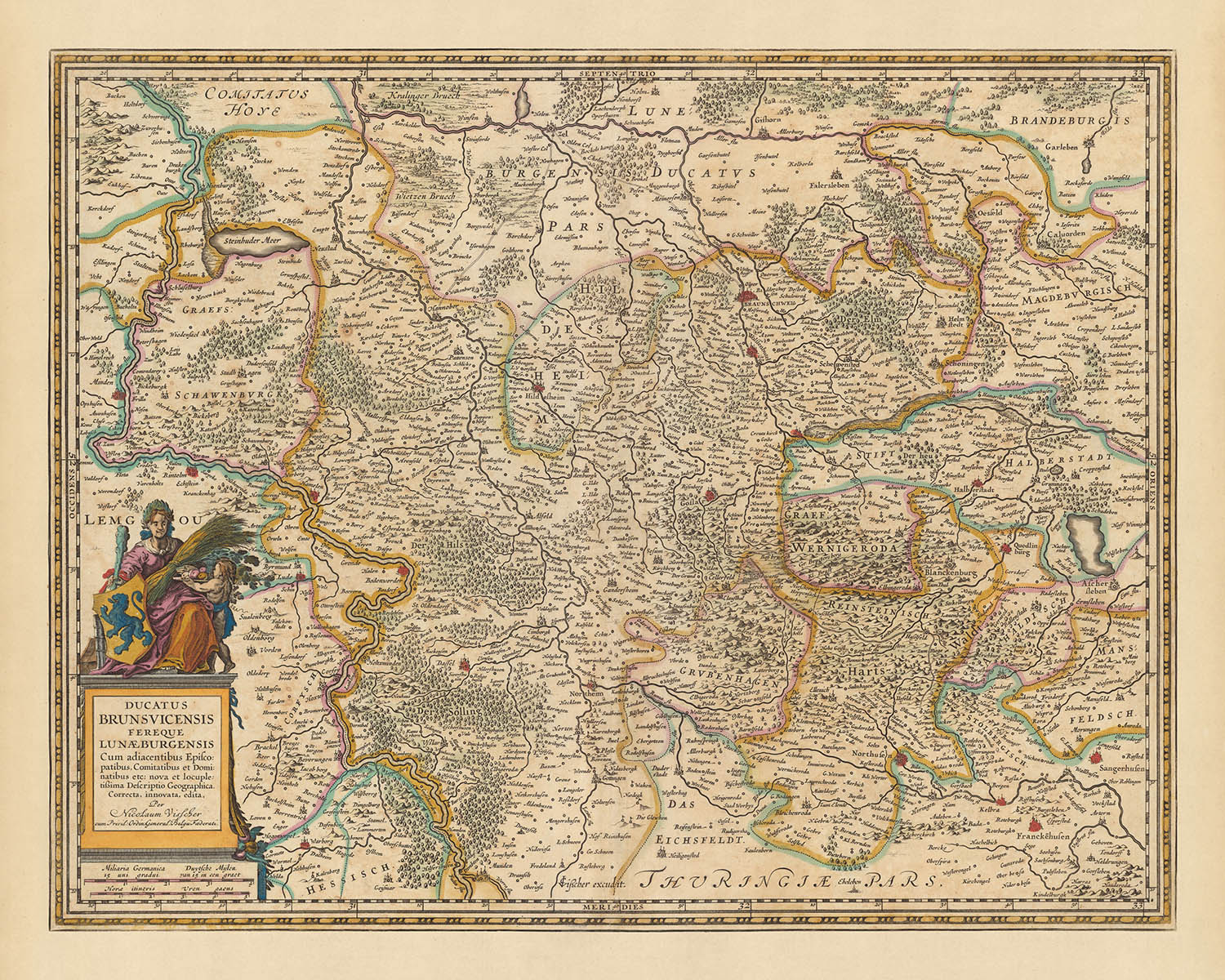
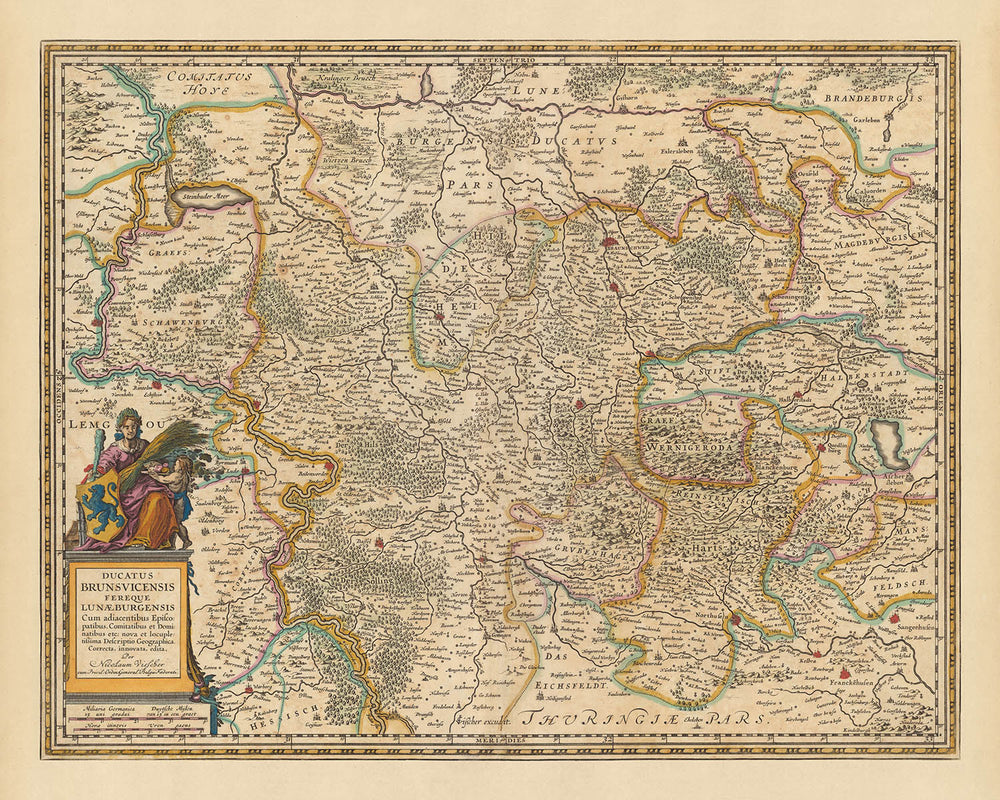
Presentiamo il 'Ducatus Brunsvicensis fereque Lunaeburgensis cum adiacentibus episcopatibus, comitatibus et dominatibus', una magnifica rappresentazione cartografica di Brunswick e Lüneburg, realizzata dal rinomato Nicolaes Visscher II nel 1690. Questo titolo, tradotto in italiano, significa 'Il Ducato di Brunswick e quasi Lüneburg con i vescovadi, contee e domini adiacenti'. Questa mappa racchiude le intricate divisioni politiche e le regioni di quella che ora fa parte della Germania moderna.
Il punto focale di questa mappa sono le regioni di Brunswick e Lüneburg, aree conosciute per la loro importanza storica e ricchezza culturale. Brunswick, un tempo una potente e influente città indipendente, è splendidamente rappresentata nella sua piena gloria. Lüneburg, una città produttrice di sale che era una parte importante della Lega Anseatica, è anch'essa dettagliatamente descritta. La mappa riflette lo stile cartografico preciso e dettagliato che era caratteristico dell'età dell'oro olandese.
In particolare, la mappa evidenzia anche città chiave come Hannover, Wolfsburg, Hildesheim e Göttingen. Hannover, capitale del Regno di Hannover, era un importante centro di potere reale. Wolfsburg, nota per il suo legame con la Casa di Welf, Hildesheim, una città storica che risale al Medioevo, e Göttingen, una città conosciuta per la sua università, sono tutte rappresentate con le loro caratteristiche uniche.
La mappa mostra anche il Parco Nazionale di Harz, una vasta area boschiva che ospita il Brocken, la vetta più alta della Germania settentrionale. Questa caratteristica aggiunge un tocco di bellezza naturale alla mappa, contrastando le aree urbane e i confini politici. Questa mappa non è solo una rappresentazione geografica, ma anche un viaggio nel passato, fornendo uno sguardo sulla ricca storia e cultura di queste regioni durante la fine del XVII secolo.
Alcuni dei luoghi significativi mostrati su questa mappa:
Ducato di Brunswick
- Brunswick (Braunschweig): Conosciuta per la sua ricca storia, Brunswick era una città indipendente influente e un centro culturale durante il Medioevo. Conosciuta anche come Braunschweig in tedesco.
- Wolfenbüttel: Un tempo residenza dei duchi di Brunswick per oltre 400 anni, è nota per la Biblioteca Herzog August, che era una delle più grandi biblioteche in Europa durante il XVII secolo.
- Peine: Una città antica risalente al 1218, era nota per l'estrazione di minerale di ferro.
- Salzgitter: Sebbene ora sia una grande città industriale, era un piccolo insediamento nel XVII secolo noto per i suoi ricchi depositi di minerale di ferro.
- Helmstedt: Conosciuta per la sua università fondata nel 1576, era un importante centro di apprendimento nel XVII secolo.
- Goslar: Una città storica nota per la sua architettura medievale ben conservata e le miniere d'argento.
- Wernigerode: Conosciuta per le sue pittoresche case a graticcio, era un insediamento significativo durante il Medioevo.
- Halberstadt: Un importante centro di produzione e commercio di vino nel Medioevo.
- Quedlinburg: Nota per la sua architettura romanica e le sue strade acciottolate, era una città reale e imperiale importante nel Medioevo.
- Blankenburg: Nota per il suo castello, è stata la residenza dei duchi di Brunswick per un certo periodo.
- Seesen: Una città storica nota per le sue case a travi di legno.
- Gifhorn : Conosciuto per il suo castello d'acqua, era un insediamento significativo durante il Medioevo.
- Celle: Conosciuto per il suo palazzo ducale, era la residenza dei duchi di Brunswick-Lüneburg.
- Uelzen: Conosciuto per la sua architettura medievale, era una importante città commerciale nel Medioevo.
- Lüchow: Conosciuto per le sue case a graticcio, era un insediamento significativo durante il Medioevo.
Ducato di Lüneburg
- Lüneburg: Conosciuto per la sua produzione di sale, era una parte importante della Lega Anseatica.
- Hanover (Hannover): La capitale del Regno di Hannover, era un importante centro di potere reale.
- Hildesheim: Una città storica risalente al Medioevo, nota per la sua architettura romanica.
- Göttingen: Conosciuto per la sua università fondata nel 1734, era un importante centro di apprendimento.
- Wolfsburg: Conosciuto per la sua associazione con la Casa di Welf, era un insediamento significativo durante il Medioevo.
- Stade: Conosciuto per il suo porto storico, era una importante città commerciale.
- Cuxhaven: Conosciuto per la sua industria della pesca, era un insediamento significativo durante il Medioevo.
- Lübeck: Conosciuto per la sua architettura gotica in mattoni, era la regina della Lega Anseatica.
- Kiel: Conosciuto per il suo porto, era una importante base navale durante il Medioevo.
- Flensburg: Conosciuto per il suo porto storico, era una importante città commerciale.
- Amburgo: Conosciuto per il suo porto, era un membro importante della Lega Anseatica medievale.
- Bremen: Conosciuto per la sua piazza del mercato, era una importante città commerciale e membro della Lega Anseatica.
- Oldenburg: Conosciuto per il suo castello, era la residenza dei conti di Oldenburg.
- Osnabrück: Conosciuto per la sua università fondata nel 1576, era un importante centro di apprendimento.
- Münster: Conosciuto per il suo centro storico, era una importante città commerciale nel Medioevo.
Caratteristiche Naturali Notabili
- Parco Nazionale Harz: Una vasta area boschiva che ospita il Brocken, la cima più alta della Germania settentrionale.
- Fiume Elba: Uno dei principali fiumi dell'Europa centrale, che scorre attraverso diversi paesi prima di sfociare nel Mare del Nord.
- Fiume Weser: Conosciuto per la sua bellezza paesaggistica, è uno dei principali fiumi nel nord della Germania.
- Fiume Ems: Un fiume importante nel nord-ovest della Germania, noto per la sua ricca biodiversità.
- Heath di Lüneburg: Una vasta area di brughiera, geest e boschi nella parte nord-orientale della Bassa Sassonia.
Eventi Storici Notabili (1600-1690)
- Guerra dei Trent'anni (1618-1648): Una serie di guerre in Europa centrale, uno dei conflitti più distruttivi nella storia europea.
- Pace di Westfalia (1648): Una serie di trattati di pace firmati nelle città westfaliane di Osnabrück e Münster, che pongono fine alle guerre di religione europee.
- Guerra di Successione di Brunswick-Lüneburg (1671): Un conflitto per l'eredità del principato di Lüneburg.
Per favore, controlla attentamente le immagini per assicurarti che una specifica città o luogo sia mostrato su questa mappa. Puoi anche contattarci e chiedere di controllare la mappa per te.
Questa mappa appare fantastica in tutte le dimensioni: 12x16in (30.5x41cm), 16x20in (40.5x51cm), 18x24in (45.5x61cm), 24x30in (61x76cm), 32x40in (81.5x102cm), 40x50in (102x127cm), 48x60in (122x153cm) e 56x70in (142x178cm), ma appare ancora meglio quando stampata in grande.
Posso creare bellissime stampe grandi di questa mappa fino a 100in (254cm). Per favore, contattami se stai cercando opzioni di incorniciatura più grandi, personalizzate o diverse.
Il modello nelle immagini dell'elenco tiene la versione 16x20in (40.5x51cm) di questa mappa.
La quinta immagine dell'elenco mostra un esempio del mio servizio di personalizzazione della mappa.
Se stai cercando qualcosa di leggermente diverso, dai un'occhiata alla mia collezione delle migliori vecchie mappe d'Europa e delle città europee per vedere se qualcosa attira la tua attenzione.
Per favore contattami per verificare se una certa posizione, un punto di riferimento o una caratteristica è mostrata su questa mappa.
Questa sarebbe una meravigliosa idea regalo per un compleanno, Natale, Festa del Papà, un congedo dal lavoro, un anniversario o una festa di inaugurazione per qualcuno delle zone coperte da questa mappa.
Questa mappa è disponibile come stampa giclée su carta opaca archiviata priva di acidi, oppure puoi acquistarla incorniciata. La cornice è una bella e semplice cornice nera che si adatta alla maggior parte degli stili. Per favore, contattami se desideri un colore o un materiale di cornice diverso. Le mie cornici sono dotate di vetro acrilico super chiaro di grado museale (perspex/acrylite), che è significativamente meno riflettente del vetro, più sicuro e arriverà sempre in perfette condizioni.
This map is also available as a float framed canvas, sometimes known as a shadow gap framed canvas or canvas floater. The map is printed on artist's cotton canvas and then stretched over a handmade box frame. We then "float" the canvas inside a wooden frame, which is available in a range of colours (black, dark brown, oak, antique gold and white). This is a wonderful way to present a map without glazing in front. See some examples of float framed canvas maps and explore the differences between my different finishes.
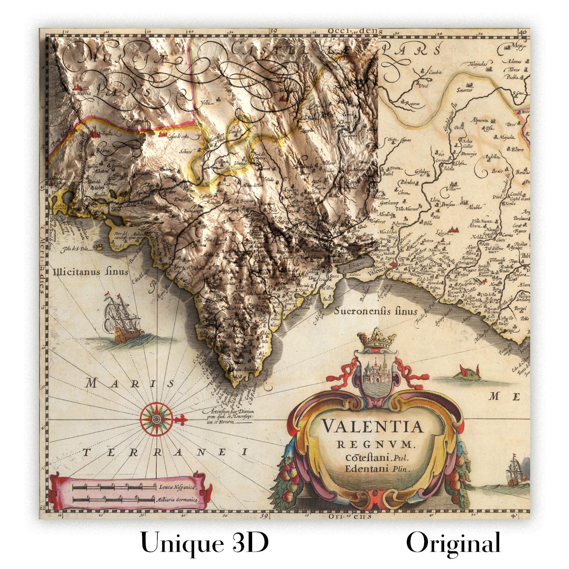
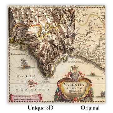
For something truly unique, this map is also available in "Unique 3D", our trademarked process that dramatically transforms the map so that it has a wonderful sense of depth. We combine the original map with detailed topography and elevation data, so that mountains and the terrain really "pop". For more info and examples of 3D maps, check my Unique 3D page.
For most orders, delivery time is about 3 working days. Personalised and customised products take longer, as I have to do the personalisation and send it to you for approval, which usually takes 1 or 2 days.
Please note that very large framed orders usually take longer to make and deliver.
If you need your order to arrive by a certain date, please contact me before you order so that we can find the best way of making sure you get your order in time.
I print and frame maps and artwork in 23 countries around the world. This means your order will be made locally, which cuts down on delivery time and ensures that it won't be damaged during delivery. You'll never pay customs or import duty, and we'll put less CO2 into the air.
All of my maps and art prints are well packaged and sent in a rugged tube if unframed, or surrounded by foam if framed.
I try to send out all orders within 1 or 2 days of receiving your order, though some products (like face masks, mugs and tote bags) can take longer to make.
If you select Express Delivery at checkout your order we will prioritise your order and send it out by 1-day courier (Fedex, DHL, UPS, Parcelforce).
Next Day delivery is also available in some countries (US, UK, Singapore, UAE) but please try to order early in the day so that we can get it sent out on time.
My standard frame is a gallery style black ash hardwood frame. It is simple and quite modern looking. My standard frame is around 20mm (0.8in) wide.
I use super-clear acrylic (perspex/acrylite) for the frame glass. It's lighter and safer than glass - and it looks better, as the reflectivity is lower.
Six standard frame colours are available for free (black, dark brown, dark grey, oak, white and antique gold). Custom framing and mounting/matting is available if you're looking for something else.
Most maps, art and illustrations are also available as a framed canvas. We use matte (not shiny) cotton canvas, stretch it over a sustainably sourced box wood frame, and then 'float' the piece within a wood frame. The end result is quite beautiful, and there's no glazing to get in the way.
All frames are provided "ready to hang", with either a string or brackets on the back. Very large frames will have heavy duty hanging plates and/or a mounting baton. If you have any questions, please get in touch.
See some examples of my framed maps and framed canvas maps.
Alternatively, I can also supply old maps and artwork on canvas, foam board, cotton rag and other materials.
If you want to frame your map or artwork yourself, please read my size guide first.
Alcune delle mie vecchie mappe sono ora disponibili come tele incorniciate. Per favore contattami se desideri ordinare una dimensione che non è disponibile nel mio negozio.
Le vecchie mappe su tela sono un'alternativa interessante alle mappe incorniciate in modo convenzionale. A seconda del tuo gusto personale e dell'arredamento della stanza, le mappe su tela possono "risaltare" un po' di più rispetto a una mappa incorniciata.
My maps are extremely high quality reproductions of original maps.
I source original, rare maps from libraries, auction houses and private collections around the world, restore them at my London workshop, and then use specialist giclée inks and printers to create beautiful maps that look even better than the original.
My maps are printed on acid-free archival matte (not glossy) paper that feels very high quality and almost like card. In technical terms the paper weight/thickness is 10mil/200gsm. It's perfect for framing.
I print with Epson ultrachrome giclée UV fade resistant pigment inks - some of the best inks you can find.
I can also make maps on canvas, cotton rag and other exotic materials.
Learn more about The Unique Maps Co.
Map personalisation
If you're looking for the perfect anniversary or housewarming gift, I can personalise your map to make it truly unique. For example, I can add a short message, or highlight an important location, or add your family's coat of arms.
The options are almost infinite. Please see my map personalisation page for some wonderful examples of what's possible.
To order a personalised map, select "personalise your map" before adding it to your basket.
Get in touch if you're looking for more complex customisations and personalisations.
Map ageing
I have been asked hundreds of times over the years by customers if they could buy a map that looks even older.
Well, now you can, by selecting Aged before you add a map to your basket.
All the product photos you see on this page show the map in its Original form. This is what the map looks like today.
If you select Aged, I will age your map by hand, using a special and unique process developed through years of studying old maps, talking to researchers to understand the chemistry of aging paper, and of course... lots of practice!
If you're unsure, stick to the Original colour of the map. If you want something a bit darker and older looking, go for Aged.
Se non sei soddisfatto del tuo ordine per qualsiasi motivo, contattami per un rimborso senza problemi. Si prega di consultare la nostra politica di reso e rimborso per ulteriori informazioni.
Sono molto sicuro che ti piacerà la tua mappa restaurata o la stampa d'arte. Lo faccio dal 1984. Sono un venditore Etsy a 5 stelle. Ho venduto decine di migliaia di mappe e stampe d'arte e ho oltre 5.000 recensioni reali a 5 stelle.
Utilizzo un processo unico per restaurare mappe e opere d'arte che richiede molto tempo e lavoro. Trovare le mappe e le illustrazioni originali può richiedere mesi. Utilizzo tecnologia all'avanguardia e incredibilmente costosa per scannerizzare e restaurarle. Di conseguenza, garantisco che le mie mappe e stampe d'arte siano superiori alle altre - ecco perché posso offrire un rimborso senza problemi.
Quasi tutte le mie mappe e stampe d'arte sembrano fantastiche a grandi dimensioni (200 cm, 6,5 piedi+) e posso anche incorniciarle e consegnarle a te, tramite un corriere speciale per oggetti di grandi dimensioni. Contattami per discutere delle tue esigenze specifiche.
Or try searching for something!


