


Mappa antica della Via della Seta, 1640 di Willem Blaeu & The Unique Maps Co.

-
![]() Handmade in Australia
Handmade in Australia
-
FREE delivery in 3-4 days ⓘ
Free delivery in 3-4 days
Your map should be delivered in 3-4 working days with free delivery, worldwide.
Please use Express Delivery at checkout for Christmas orders. Framed orders may arrive with Express Delivery, but it is not guaranteed.
New for 2025: After you order, you can send a beautiful gift preview by email, if you're worried it won't arrive on time.
We make maps by hand locally in 23 countries, including Australia
![]() . If you're buying a gift for someone in another country, we will make the map locally to them.
. If you're buying a gift for someone in another country, we will make the map locally to them.You will never pay import tax or customs duty.
Check the Christmas delivery guide for order deadlines. Delivery times are starting to slow down, and will continue to slow down towards Christmas.
Express delivery is available at checkout which can reduce the delivery time to 1-2 days.
Please note that personalised maps, and larger framed maps, can take longer to produce and deliver.
If you need your order to arrive by a certain date, contact me and we can discuss your options.
-
FREE gift preview
ⓘ
Digital gift preview
New for 2025: After you complete your order, you can send a beautiful digital preview to the gift recipient. Just provide their email address and we'll do the rest. (Their email address will not be stored or used for any other purpose.)
This is perfect for Christmas gifting, particularly if you're concerned that your order might not arrive in time for Christmas.
-
90 day money back guarantee
ⓘ
90 giorni per restituire e ricevere un rimborso
I prodotti possono essere restituiti entro 90 giorni per un rimborso completo, o cambio con un altro prodotto.
Per articoli personalizzati e su misura, potremmo offrirti un credito in negozio o una carta regalo non scadente, poiché non possiamo rivendere ordini personalizzati.
Se hai domande, contattaci. Per ulteriori informazioni, consulta la nostra politica di restituzione e cambio.

My maps are rare, museum-grade, restored old maps sourced from libraries, auction houses and private collections across the globe.
Framing & free personalisation available
1. Select your size
2. Frame & personalise your map
There is limited framing & personalisation capacity available. Order by 10am tomorrow for Christmas delivery.


Gift message & custom finish

If you want to add a gift message, or a finish (jigsaw, aluminium board, etc.) that is not available here, please request it in the "order note" when you check out.
Every order is custom made, so if you need the size adjusted slightly, or printed on an unusual material, just let us know. We've done thousands of custom orders over the years, so there's (almost) nothing we can't manage.
You can also contact us before you order, if you prefer!

- Handmade locally. No import duty or tax
- FREE Delivery by Christmas
- Love it or your money back (90 days)
- Questions? WhatsApp me any time
Own a piece of history
5,000+ 5 star reviews


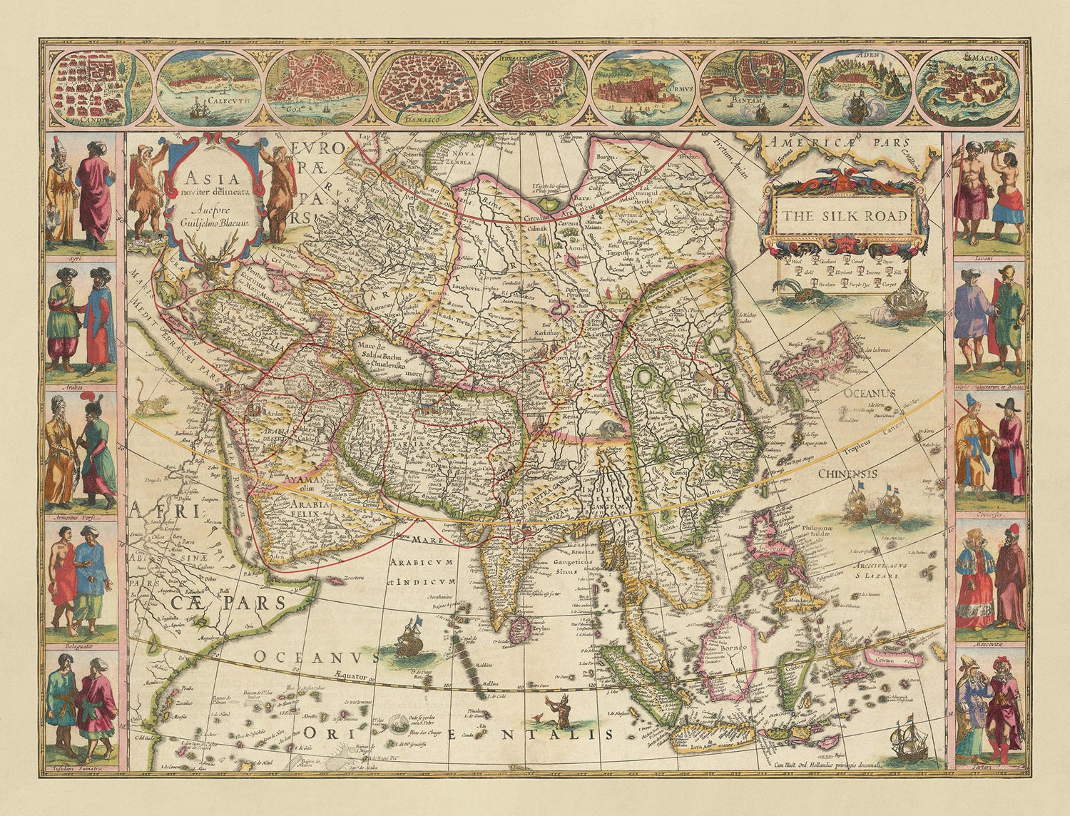
Entra nella ricca trama della storia con questa squisita mappa della Via della Seta, magistralmente progettata da The Unique Maps Co. nel 2024, e basata su una mappa dell'Asia del rinomato cartografo Willem Blaeu nel 1640.
Questa mappa sovrappone in modo unico una rappresentazione moderna della Via della Seta alla mappa antica di Blaeu dell'Asia, offrendo una fusione affascinante di prospettive storiche e contemporanee. La Via della Seta, una leggendaria rete di rotte commerciali, collegava l'Est e l'Ovest, facilitando non solo lo scambio di beni ma anche l'intercambio di cultura, tecnologia e idee. Questa mappa cattura l'essenza di questa vibrante arteria storica, rendendola un pezzo inestimabile per qualsiasi appassionato di storia o collezionista.
Una delle caratteristiche più affascinanti di questa mappa sono le illustrazioni dettagliate che adornano la Via della Seta. Mercanti, cammelli e altri simboli iconici del commercio antico sono meticolosamente raffigurati, riportando in vita l'attività frenetica che un tempo prosperava lungo queste rotte. La mappa include anche una leggenda completa nell'angolo in alto a destra, evidenziando la vasta gamma di prodotti che si muovevano lungo la Via della Seta, come lana, seta, qashani, cammelli, carta, oro, elefanti, incenso, porcellana, tintura viola e tappeti. Queste illustrazioni e leggende non solo migliorano l'appeal visivo della mappa, ma forniscono anche una comprensione più profonda del significato storico della Via della Seta.
La mappa mostra l'ampia estensione di regioni e paesi che erano interconnessi dalla Via della Seta, inclusi Cina, India, Persia e parti del Medio Oriente. Città importanti come Samarcanda, Kashgar e Xi'an sono presentate in modo prominente, ognuna giocando un ruolo cruciale nella rete commerciale. I dettagli intricati delle caratteristiche topografiche, come montagne e fiumi, aggiungono autenticità e accuratezza storica alla mappa. Questa rappresentazione geografica offre uno sguardo nei paesaggi diversificati che i mercanti attraversavano, arricchendo ulteriormente la narrazione della Via della Seta.
La maestria artistica di Willem Blaeu è evidente negli elementi decorativi che incorniciano la mappa. I bordi sono adornati con illustrazioni di persone, eventi e scambi culturali, riflettendo le ricche interazioni che avvenivano lungo la Via della Seta. La mappa è anche abbellita con cartigli decorativi e motivi a spirale, aggiungendo un tocco di eleganza e grandiosità. Le rotte marittime e le navi raffigurate negli oceani circostanti evidenziano l'importanza del commercio marittimo nel completare le rotte terrestri della Via della Seta. Questi elementi artistici non solo migliorano l'appeal estetico della mappa, ma forniscono anche una narrazione visiva del contesto storico.
Il significato storico di questa mappa non può essere sopravvalutato. La Via della Seta è stata strumentale nel plasmare il corso della storia, promuovendo scambi economici e culturali che hanno lasciato un'impronta indelebile sulle civiltà. Questa mappa serve come testimonianza dell'eredità duratura della Via della Seta, catturando l'essenza di un'epoca passata che ha portato il lontano oriente in Europa. Per collezionisti, storici o chiunque abbia una passione per la ricca trama della storia umana, questa mappa è un tesoro di conoscenza e bellezza, offrendo una finestra sul passato e una maggiore comprensione del mondo interconnesso in cui viviamo oggi.
Il Viaggio della Via della Seta: Commercio e Cultura
La Via della Seta, istituita durante la dinastia Han intorno al II secolo a.C., era una rete significativa di rotte commerciali che collegava l'Est e l'Ovest. Ha favorito non solo il commercio, ma anche lo scambio culturale e di conoscenze. Originaria della Cina, la Via della Seta facilitava il commercio di seta squisita, molto ambita in terre lontane. Inoltre, la Cina introduceva altri beni significativi come porcellana, carta, tè e spezie.
Man mano che la rotta si estendeva verso ovest, diverse regioni contribuivano con beni preziosi: l'India forniva tessuti in cotone pregiato, spezie e gemme. I mercanti indiani portavano anche con sé la conoscenza del buddismo che si diffondeva in altre parti dell'Asia. La Persia (l'attuale Iran) offriva tappeti intricati, ceramiche squisite e zafferano.
Il viaggio continuava attraverso il Medio Oriente dove i mercanti arabi scambiavano incenso, mirra e olibano, molto apprezzati per il loro uso in cerimonie religiose e profumeria. Inoltre, i commercianti arabi portavano conoscenze scientifiche, comprese le innovazioni in matematica e astronomia, che avrebbero successivamente influenzato il Rinascimento in Europa.
Città dell'Asia Centrale, come Samarcanda e Bukhara, prosperavano come vivaci centri commerciali, scambiando articoli come lapislazzuli e cavalli. Istanbul, precedentemente Bisanzio e Costantinopoli, emergeva come un hub cruciale, collegando la Via della Seta con l'Europa e facilitando il flusso di spezie, metalli e tessuti.
Infine, la Via della Seta estendeva la sua influenza in Europa. Mentre l'Europa importava principalmente beni come seta, spezie e pietre preziose, contribuiva anche con articoli come vetro, tessuti di lana e vino. I mercanti europei, spinti dall'attrazione delle ricchezze orientali, intraprendevano viaggi pericolosi per riportare questi tesori nelle loro terre d'origine.
Oltre ad essere una semplice rotta commerciale, la Via della Seta è stata fondamentale nel favorire lo scambio culturale, la diffusione religiosa e i progressi scientifici, arricchendo così le civiltà che collegava. Sebbene la sua importanza sia diminuita con l'emergere delle rotte commerciali marittime, l'eredità della Via della Seta perdura come testimonianza dell'interconnessione della civiltà umana e dello spirito duraturo di esplorazione e scambio.
Luoghi su questa mappa
- Samarcanda
- Kashgar
- Xi'an
- Persia
- Cina
- India
- Arabia Felix
- Catai
- Borneo
- Sumatra
- Giava
- Tartaria
- Mesopotamia
- Armenia
- Siria
- Egitto
- Turchia
- Mongolia
- Tibet
- Malacca
- Kazakhstan
Caratteristiche e Monumenti Notabili
- Illustrazioni di commercianti e cammelli lungo la Via della Seta
- Legenda nell'angolo in alto a destra che mostra i diversi prodotti movimentati lungo la Via della Seta
- Icone corrispondenti sulla rotta della Via della Seta che indicano prodotti commerciali specifici
- Illustrazioni dettagliate e rappresentazioni di città e regioni
- Rotte commerciali principali evidenziate
- Diverse regioni dell'Asia, comprese Cina, India, Persia e Medio Oriente
- Città e monumenti storici
- Bordi artistici con ulteriori illustrazioni di persone ed eventi
- Rotte marittime e navi rappresentate negli oceani circostanti
- Cartouches decorativi e lavorazioni a spirale
- La mappa è intitolata "La Via della Seta" in modo prominente nell'angolo in alto a destra
- Caratteristiche topografiche dettagliate come montagne e fiumi
- Città principali lungo la Via della Seta come Samarcanda, Kashgar e Xi'an
- Illustrazioni di scambi e interazioni culturali
- Rappresentazioni di diversi gruppi etnici e dei loro abiti
- Rappresentazione artistica dell'antico ambiente commerciale
- Insetti di luoghi o eventi significativi lungo la Via della Seta
- Rosone per l'orientamento
- Confini e territori come compresi nel XVII secolo
- Rappresentazione artistica della flora e della fauna
- Scala della mappa e indicatori di distanza
- Illustrazioni di antichi beni commerciali come seta, lana e oro
Contesto storico e di design
- Questa è una mappa moderna della Via della Seta creata da The Unique Maps Co., sovrapposta a una mappa antica dell'Asia di Willem Blaeu.
- Non ci sono state mappe della Via della Seta pubblicate in antichità, rendendo questa una mappa unica, possibilmente la prima del suo genere.
- Illustrazioni deliziose possono essere trovate lungo la Via della Seta di commercianti, cammelli, ecc.
- C'è una legenda utile nell'angolo in alto a destra che mostra i diversi prodotti che si muovevano lungo la Via della Seta, tra cui Lana, Seta, Qashani, Cammelli, Carta, Oro, Elefante, Incenso, Porcellana, Colorante Viola e Tappeto.
- Icone corrispondenti lungo il percorso della Via della Seta indicano quali prodotti si muovevano lungo quali parti della Via della Seta.
- Una mappa straordinaria per chiunque sia interessato alla storia dell'Asia e a come la Via della Seta alla fine portò 'l'estremo oriente' in Europa.
- Willem Blaeu era un noto cartografo olandese, creatore di atlanti e editore nel XVII secolo.
- La Via della Seta era una rete di rotte commerciali che collegava l'Est e l'Ovest dal II secolo a.C. al XVIII secolo.
- Ha svolto un ruolo cruciale nello scambio culturale, commerciale e tecnologico tra le regioni.
- La mappa presenta una combinazione di design cartografico antico con sovrapposizioni moderne.
- Illustrazioni ricche e legenda dettagliata.
- La Via della Seta è stata fondamentale nel plasmare il corso della storia, favorendo scambi economici e culturali che hanno lasciato un'impronta indelebile sulle civiltà.
Si prega di controllare attentamente le immagini per assicurarsi che una specifica città o luogo sia mostrato su questa mappa. Puoi anche contattarci e chiedere di controllare la mappa per te.
Questa mappa appare fantastica in ogni dimensione, ma consiglio sempre di optare per una dimensione più grande se hai spazio. In questo modo puoi facilmente distinguere tutti i dettagli.
Questa mappa appare sorprendente in dimensioni fino a 90in (230cm). Se stai cercando una mappa più grande, per favore contattaci.
Si prega di notare: le etichette su questa mappa sono difficili da leggere se ordini una mappa che è 16in (40cm) o più piccola. La mappa è comunque molto attraente, ma se desideri leggere facilmente la mappa, ti preghiamo di acquistare una dimensione più grande.
Il modello nelle immagini dell'elenco tiene in mano la versione 18x24in (45x60cm) di questa mappa.
La quinta immagine dell'elenco mostra un esempio del mio servizio di personalizzazione della mappa.
Se stai cercando qualcosa di leggermente diverso, dai un'occhiata alla mia collezione dei migliori mappe antiche per vedere se qualcosa altro cattura la tua attenzione.
Per favore contattami per controllare se una certa località, punto di riferimento o caratteristica è mostrata su questa mappa.
Questo sarebbe un meraviglioso regalo per un compleanno, Natale, Festa del Papà, pensionamento, anniversario o inaugurazione di una casa per qualcuno delle aree coperte da questa mappa.
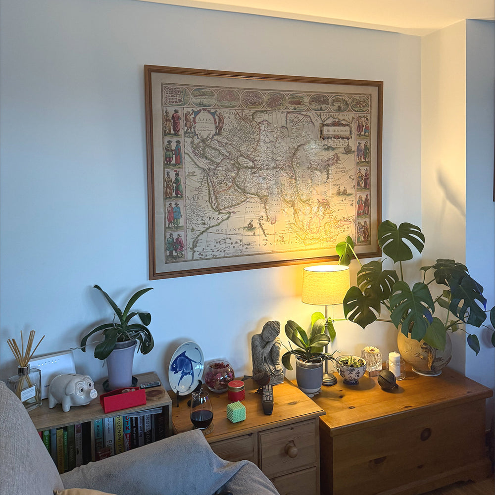
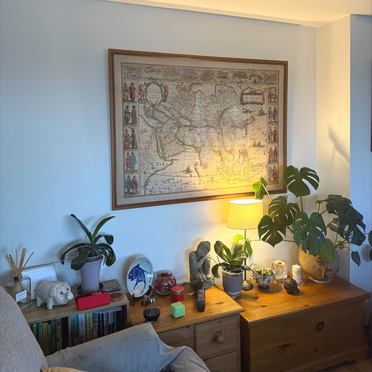
Questa mappa è disponibile come stampa giclée su carta opaca archiviabile senza acidi, oppure puoi acquistarla incorniciata. La cornice è una semplice cornice nera che si adatta alla maggior parte degli stili. Ti preghiamo di contattarci se desideri un colore o un materiale diverso per la cornice. Le mie cornici sono dotate di un vetro acrilico museo super chiaro (perspex/acrylite), che è significativamente meno riflettente del vetro, più sicuro e arriverà sempre in perfette condizioni.
This map is also available as a float framed canvas, sometimes known as a shadow gap framed canvas or canvas floater. The map is printed on artist's cotton canvas and then stretched over a handmade box frame. We then "float" the canvas inside a wooden frame, which is available in a range of colours (black, dark brown, oak, antique gold and white). This is a wonderful way to present a map without glazing in front. See some examples of float framed canvas maps and explore the differences between my different finishes.
For something truly unique, this map is also available in "Unique 3D", our trademarked process that dramatically transforms the map so that it has a wonderful sense of depth. We combine the original map with detailed topography and elevation data, so that mountains and the terrain really "pop". For more info and examples of 3D maps, check my Unique 3D page.
For most orders, delivery time is about 3 working days. Personalised and customised products take longer, as I have to do the personalisation and send it to you for approval, which usually takes 1 or 2 days.
Please note that very large framed orders usually take longer to make and deliver.
If you need your order to arrive by a certain date, please contact me before you order so that we can find the best way of making sure you get your order in time.
I print and frame maps and artwork in 23 countries around the world. This means your order will be made locally, which cuts down on delivery time and ensures that it won't be damaged during delivery. You'll never pay customs or import duty, and we'll put less CO2 into the air.
All of my maps and art prints are well packaged and sent in a rugged tube if unframed, or surrounded by foam if framed.
I try to send out all orders within 1 or 2 days of receiving your order, though some products (like face masks, mugs and tote bags) can take longer to make.
If you select Express Delivery at checkout your order we will prioritise your order and send it out by 1-day courier (Fedex, DHL, UPS, Parcelforce).
Next Day delivery is also available in some countries (US, UK, Singapore, UAE) but please try to order early in the day so that we can get it sent out on time.
My standard frame is a gallery style black ash hardwood frame. It is simple and quite modern looking. My standard frame is around 20mm (0.8in) wide.
I use super-clear acrylic (perspex/acrylite) for the frame glass. It's lighter and safer than glass - and it looks better, as the reflectivity is lower.
Six standard frame colours are available for free (black, dark brown, dark grey, oak, white and antique gold). Custom framing and mounting/matting is available if you're looking for something else.
Most maps, art and illustrations are also available as a framed canvas. We use matte (not shiny) cotton canvas, stretch it over a sustainably sourced box wood frame, and then 'float' the piece within a wood frame. The end result is quite beautiful, and there's no glazing to get in the way.
All frames are provided "ready to hang", with either a string or brackets on the back. Very large frames will have heavy duty hanging plates and/or a mounting baton. If you have any questions, please get in touch.
See some examples of my framed maps and framed canvas maps.
Alternatively, I can also supply old maps and artwork on canvas, foam board, cotton rag and other materials.
If you want to frame your map or artwork yourself, please read my size guide first.
Alcune delle mie vecchie mappe sono ora disponibili come tele incorniciate. Per favore contattami se desideri ordinare una dimensione che non è disponibile nel mio negozio.
Le vecchie mappe su tela sono un'alternativa interessante alle mappe incorniciate in modo convenzionale. A seconda del tuo gusto personale e dell'arredamento della stanza, le mappe su tela possono "risaltare" un po' di più rispetto a una mappa incorniciata.
My maps are extremely high quality reproductions of original maps.
I source original, rare maps from libraries, auction houses and private collections around the world, restore them at my London workshop, and then use specialist giclée inks and printers to create beautiful maps that look even better than the original.
My maps are printed on acid-free archival matte (not glossy) paper that feels very high quality and almost like card. In technical terms the paper weight/thickness is 10mil/200gsm. It's perfect for framing.
I print with Epson ultrachrome giclée UV fade resistant pigment inks - some of the best inks you can find.
I can also make maps on canvas, cotton rag and other exotic materials.
Learn more about The Unique Maps Co.
Map personalisation
If you're looking for the perfect anniversary or housewarming gift, I can personalise your map to make it truly unique. For example, I can add a short message, or highlight an important location, or add your family's coat of arms.
The options are almost infinite. Please see my map personalisation page for some wonderful examples of what's possible.
To order a personalised map, select "personalise your map" before adding it to your basket.
Get in touch if you're looking for more complex customisations and personalisations.
Map ageing
I have been asked hundreds of times over the years by customers if they could buy a map that looks even older.
Well, now you can, by selecting Aged before you add a map to your basket.
All the product photos you see on this page show the map in its Original form. This is what the map looks like today.
If you select Aged, I will age your map by hand, using a special and unique process developed through years of studying old maps, talking to researchers to understand the chemistry of aging paper, and of course... lots of practice!
If you're unsure, stick to the Original colour of the map. If you want something a bit darker and older looking, go for Aged.
Se non sei soddisfatto del tuo ordine per qualsiasi motivo, contattami per un rimborso senza problemi. Si prega di consultare la nostra politica di reso e rimborso per ulteriori informazioni.
Sono molto sicuro che ti piacerà la tua mappa restaurata o la stampa d'arte. Lo faccio dal 1984. Sono un venditore Etsy a 5 stelle. Ho venduto decine di migliaia di mappe e stampe d'arte e ho oltre 5.000 recensioni reali a 5 stelle.
Utilizzo un processo unico per restaurare mappe e opere d'arte che richiede molto tempo e lavoro. Trovare le mappe e le illustrazioni originali può richiedere mesi. Utilizzo tecnologia all'avanguardia e incredibilmente costosa per scannerizzare e restaurarle. Di conseguenza, garantisco che le mie mappe e stampe d'arte siano superiori alle altre - ecco perché posso offrire un rimborso senza problemi.
Quasi tutte le mie mappe e stampe d'arte sembrano fantastiche a grandi dimensioni (200 cm, 6,5 piedi+) e posso anche incorniciarle e consegnarle a te, tramite un corriere speciale per oggetti di grandi dimensioni. Contattami per discutere delle tue esigenze specifiche.
Or try searching for something!


