- Handmade locally. No import duty or tax
- FREE worldwide delivery
- 90-day returns & 5-year product guarantee
- Questions? WhatsApp me any time
Own a piece of history
7,000+ 5 star reviews


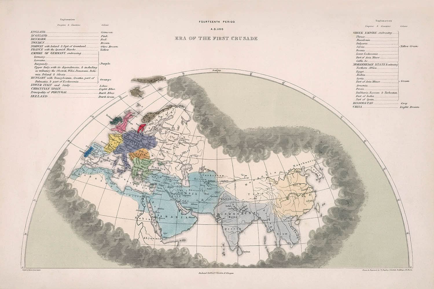
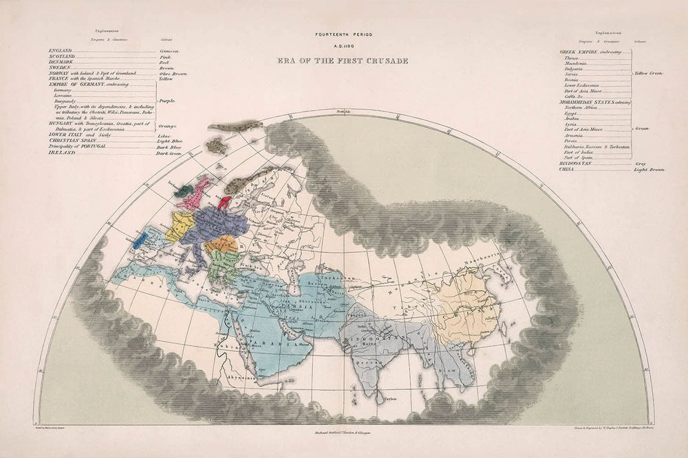
Step into the captivating world of medieval history with this exquisite map from Edward Quin's renowned Historical Atlas. Created in 1856, this map vividly illustrates the geopolitical landscape during the Era of the First Crusade, around A.D. 1100. As you explore its intricacies, you'll notice the meticulous hand-coloring that distinguishes the dominant empires of the time, such as the German Empire in regal purple, the expansive Mahammedan States in verdant green, and the vast lands of China in a subtle light brown. This map is more than just a visual delight; it serves as a window into a pivotal period when religious fervor and military ambition reshaped continents.
The map's design is a testament to Quin's innovative approach to cartography. The progressively receding cloud borders are not merely decorative; they symbolize the gradual expansion of geographical knowledge over centuries. This unique feature invites you to journey through time, witnessing how the known world expanded as explorers and scholars pushed the boundaries of understanding. Quin's atlas, of which this map is a part, was a groundbreaking work that aimed to provide a comprehensive view of universal history, making it an invaluable resource for historians and enthusiasts alike.
Historically, this map captures the essence of the First Crusade, a series of military campaigns that had profound implications for Europe and the Middle East. It highlights the key players in this historical drama, from the Byzantine Empire and the Kingdom of Jerusalem to the Islamic Caliphates. These regions were not just geographical entities; they were the stage for epic battles, cultural exchanges, and the clash of civilizations. The map serves as a reminder of the complex interplay of power, religion, and ambition that defined this era.
The detailed depiction of political entities such as the Kingdoms of France, England, and Spain offers a glimpse into the medieval power dynamics that shaped modern Europe. Each kingdom, with its distinct color and boundary, tells a story of conquest, alliance, and rivalry. The map also highlights cultural regions, reflecting the diverse tapestry of languages, traditions, and beliefs that coexisted and often clashed. This rich historical context makes the map not only a tool for navigation but also a narrative of human endeavor and aspiration.
Owning this map is akin to possessing a piece of history. It invites you to delve into the past, exploring the empires and kingdoms that once dominated the world stage. Whether you're a history aficionado, a collector of rare maps, or someone with a passion for the medieval era, this map offers a unique blend of art and history. It stands as a testament to the enduring legacy of the First Crusade and the ever-evolving understanding of our world's geography.
Places on this map
- German Empire
- Byzantine Empire
- Kingdom of France
- Kingdom of England
- Kingdom of Scotland
- Kingdom of Norway
- Kingdom of Sweden
- Kingdom of Denmark
- Kingdom of Hungary
- Kingdom of Poland
- Kingdom of Spain
- Kingdom of Portugal
- Kingdom of Italy
- Kingdom of Sicily
- Kingdom of Jerusalem
- China
- Islamic Caliphates
- Mahammedan States
- Asia Minor
- India
Notable Features & Landmarks
- Empires and regions: German Empire, Mahammedan States, China
- Historical events: Era of the First Crusade
- Geographical features: Hand-colored regions, Cloud borders illustrating knowledge expansion
- Political entities: Byzantine Empire, Kingdom of France, Kingdom of England, Kingdom of Scotland, Kingdom of Norway, Kingdom of Sweden, Kingdom of Denmark, Kingdom of Hungary, Kingdom of Poland, Kingdom of Spain, Kingdom of Portugal, Kingdom of Italy, Kingdom of Sicily, Kingdom of Jerusalem
- Cultural regions: Islamic Caliphates, Christian kingdoms
Historical and design context
- Name of the map: Fourteenth Period: A.D. 1100. Era of the First Crusade.
- Creation date: 1856.
- Mapmaker/Publisher: Edward Quin.
- Themes and topics: Historical focus on the First Crusade, Empires and countries like the German Empire, Mahammedan States, and China.
- Design and style: Hand-colored regions with progressively receding cloud borders to symbolize the expansion of geographical understanding.
- Historical significance: Part of Quin's Historical Atlas, providing a comprehensive view of universal history from creation to 1856.
Please double check the images to make sure that a specific town or place is shown on this map. You can also get in touch and ask us to check the map for you.
This map looks great at every size, but I always recommend going for a larger size if you have space. That way you can easily make out all of the details.
This map looks amazing at sizes all the way up to 70in (180cm). If you are looking for a larger map, please get in touch.
The model in the listing images is holding the 24x36in (60x90cm) version of this map.
The fifth listing image shows an example of my map personalisation service.
If you’re looking for something slightly different, check out my collection of the best old maps to see if something else catches your eye.
Please contact me to check if a certain location, landmark or feature is shown on this map.
This would make a wonderful birthday, Christmas, Father's Day, work leaving, anniversary or housewarming gift for someone from the areas covered by this map.
This map is available as a giclée print on acid free archival matte paper, or you can buy it framed. The frame is a nice, simple black frame that suits most aesthetics. Please get in touch if you'd like a different frame colour or material. My frames are glazed with super-clear museum-grade acrylic (perspex/acrylite), which is significantly less reflective than glass, safer, and will always arrive in perfect condition.
This map is also available as a float framed canvas, sometimes known as a shadow gap framed canvas or canvas floater. The map is printed on artist's cotton canvas and then stretched over a handmade box frame. We then "float" the canvas inside a wooden frame, which is available in a range of colours (black, dark brown, oak, antique gold and white). This is a wonderful way to present a map without glazing in front. See some examples of float framed canvas maps and explore the differences between my different finishes.
For something truly unique, this map is also available in "Unique 3D", our trademarked process that dramatically transforms the map so that it has a wonderful sense of depth. We combine the original map with detailed topography and elevation data, so that mountains and the terrain really "pop". For more info and examples of 3D maps, check my Unique 3D page.
For most orders, delivery time is about 3 working days. Personalised and customised products take longer, as I have to do the personalisation and send it to you for approval, which usually takes 1 or 2 days.
Please note that very large framed orders usually take longer to make and deliver.
If you need your order to arrive by a certain date, please contact me before you order so that we can find the best way of making sure you get your order in time.
I print and frame maps and artwork in 23 countries around the world. This means your order will be made locally, which cuts down on delivery time and ensures that it won't be damaged during delivery. You'll never pay customs or import duty, and we'll put less CO2 into the air.
All of my maps and art prints are well packaged and sent in a rugged tube if unframed, or surrounded by foam if framed.
I try to send out all orders within 1 or 2 days of receiving your order, though some products (like face masks, mugs and tote bags) can take longer to make.
If you select Express Delivery at checkout your order we will prioritise your order and send it out by 1-day courier (Fedex, DHL, UPS, Parcelforce).
Next Day delivery is also available in some countries (US, UK, Singapore, UAE) but please try to order early in the day so that we can get it sent out on time.
My standard frame is a gallery style black ash hardwood frame. It is simple and quite modern looking. My standard frame is around 20mm (0.8in) wide.
I use super-clear acrylic (perspex/acrylite) for the frame glass. It's lighter and safer than glass - and it looks better, as the reflectivity is lower.
Six standard frame colours are available for free (black, dark brown, dark grey, oak, white and antique gold). Custom framing and mounting/matting is available if you're looking for something else.
Most maps, art and illustrations are also available as a framed canvas. We use matte (not shiny) cotton canvas, stretch it over a sustainably sourced box wood frame, and then 'float' the piece within a wood frame. The end result is quite beautiful, and there's no glazing to get in the way.
All frames are provided "ready to hang", with either a string or brackets on the back. Very large frames will have heavy duty hanging plates and/or a mounting baton. If you have any questions, please get in touch.
See some examples of my framed maps and framed canvas maps.
Alternatively, I can also supply old maps and artwork on canvas, foam board, cotton rag and other materials.
If you want to frame your map or artwork yourself, please read my size guide first.
My maps are extremely high quality reproductions of original maps.
I source original, rare maps from libraries, auction houses and private collections around the world, restore them at my London workshop, and then use specialist giclée inks and printers to create beautiful maps that look even better than the original.
My maps are printed on acid-free archival matte (not glossy) paper that feels very high quality and almost like card. In technical terms the paper weight/thickness is 10mil/200gsm. It's perfect for framing.
I print with Epson ultrachrome giclée UV fade resistant pigment inks - some of the best inks you can find.
I can also make maps on canvas, cotton rag and other exotic materials.
Learn more about The Unique Maps Co.
Map personalisation
If you're looking for the perfect anniversary or housewarming gift, I can personalise your map to make it truly unique. For example, I can add a short message, or highlight an important location, or add your family's coat of arms.
The options are almost infinite. Please see my map personalisation page for some wonderful examples of what's possible.
To order a personalised map, select "personalise your map" before adding it to your basket.
Get in touch if you're looking for more complex customisations and personalisations.
Map ageing
I have been asked hundreds of times over the years by customers if they could buy a map that looks even older.
Well, now you can, by selecting Aged before you add a map to your basket.
All the product photos you see on this page show the map in its Original form. This is what the map looks like today.
If you select Aged, I will age your map by hand, using a special and unique process developed through years of studying old maps, talking to researchers to understand the chemistry of aging paper, and of course... lots of practice!
If you're unsure, stick to the Original colour of the map. If you want something a bit darker and older looking, go for Aged.
If you are not happy with your order for any reason, contact me and I'll get it fixed ASAP, free of charge. Please see my returns and refund policy for more information.
I am very confident you will like your restored map or art print. I have been doing this since 1984. I'm a 5-star Etsy seller. I have sold tens of thousands of maps and art prints and have over 5,000 real 5-star reviews. My work has been featured in interior design magazines, on the BBC, and on the walls of dozens of 5-star hotels.
I use a unique process to restore maps and artwork that is massively time consuming and labour intensive. Hunting down the original maps and illustrations can take months. I use state of the art and eye-wateringly expensive technology to scan and restore them. As a result, I guarantee my maps and art prints are a cut above the rest. I stand by my products and will always make sure you're 100% happy with what you receive.
Almost all of my maps and art prints look amazing at large sizes (200cm, 6.5ft+) and I can frame and deliver them to you as well, via special oversized courier. Contact me to discuss your specific needs.
Or try searching for something!


